Day 23 August 1st
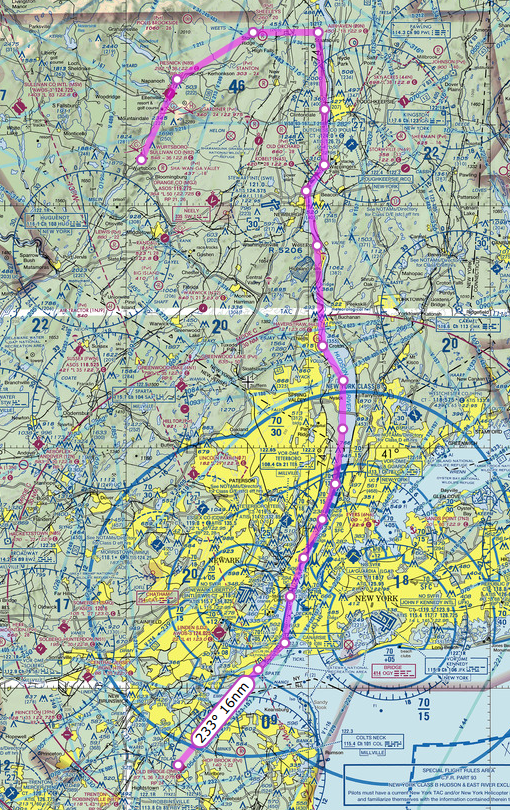 On this day we departed Wurtsboro Sullivan airport and headed south down the Hudson river. I was so excited for this day as I had planned and read up on everything I needed to do to fly the Hudson River VFR corridor.
Flying down the Hudson at 1000 feet from where we started required me to get clearance through two Class D air spaces. The first one was Dutchess County (POU), where I accidentally called them “Poughkeepsie Tower” but at least they knew what I meant. The second one was Stewart (SWF) and they were both very accommodating and understood what I was doing.
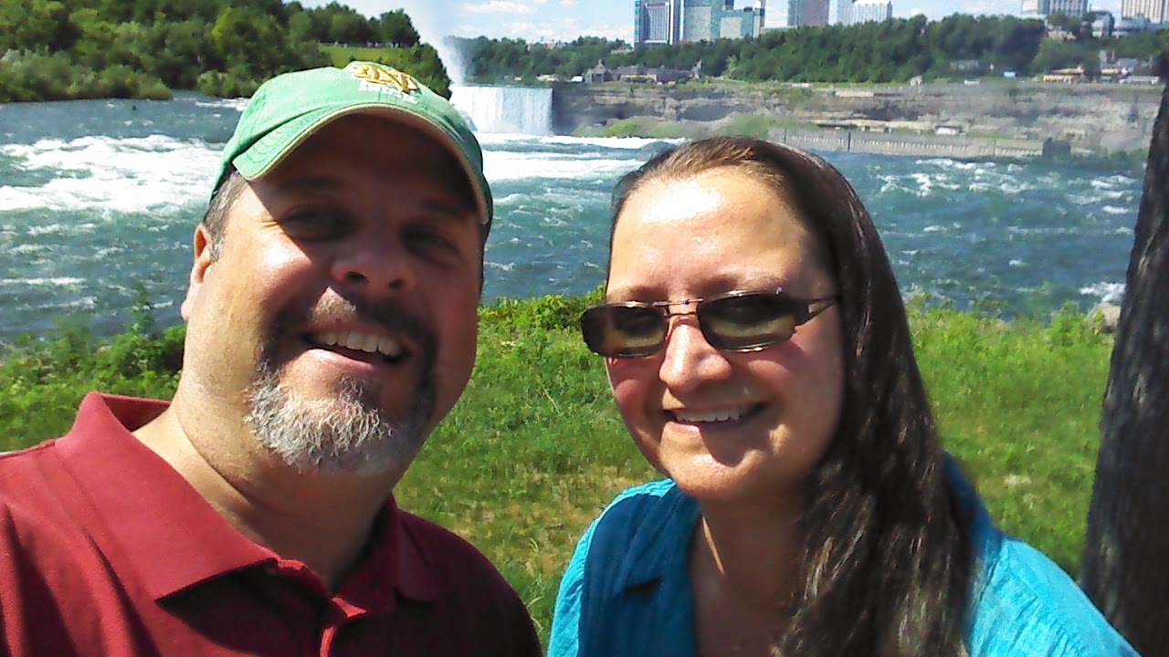
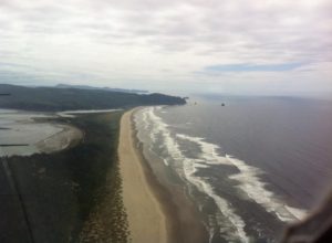
There is a lot to see flying down the river. If I were to do this portion of the trip again I would have a tourist map next to me because there were so many things to see. At this point my wife was snapping pictures in all directions all the way to New Jersey.
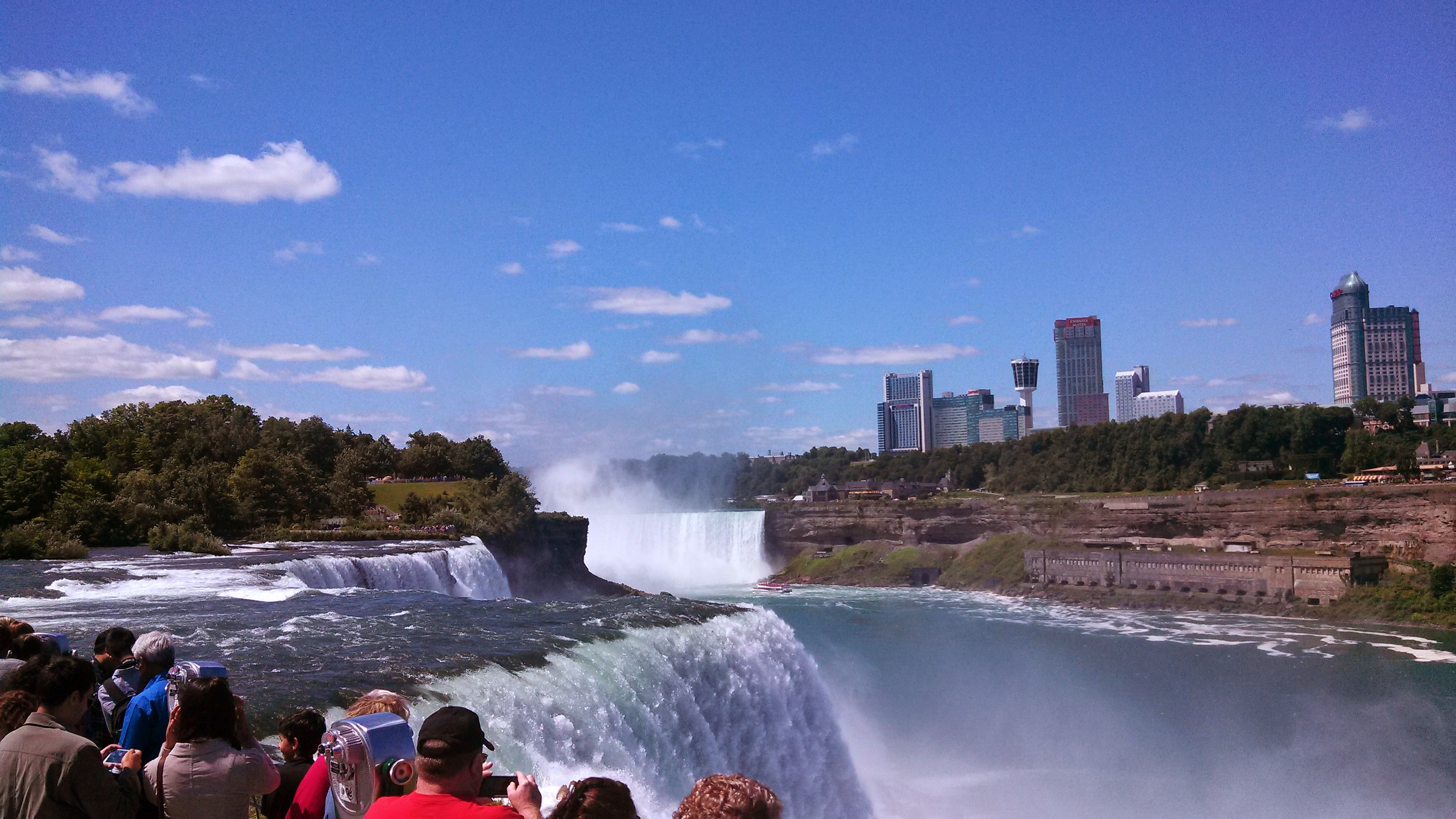
The FAA Safety site published a simple knee-board document that covers the basics of what one needs to know when flying down the Hudson VFR. This doc was very useful and easy to follow. The reporting points are very easy to see and made it no trouble whatsoever to self-announce at the designated points. I kept our airspeed relatively slow at about 90 knots, which made me feel less nervous and gave me time to see and plan for each potential hazard. Flying over the George Washington Bridge at 1000 feet is a bit intimidating, the first time, and I needed to focus to make sure I was clear of all obstacles.
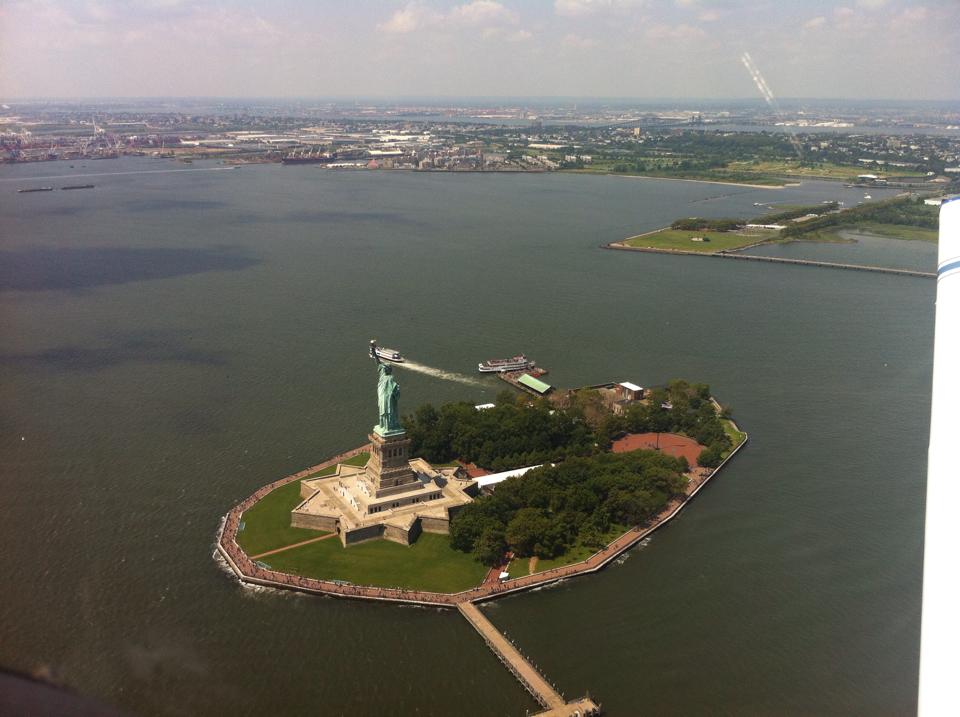
The only time I got more than normal nervous was when we were approaching the Statue of Liberty. As I was passing the Colgate Clock, I could not get a word in on the CTAF as the heliport operators were chatting away about refueling and picking up passengers and who was getting the coffee. I slowed the plane down and finally blurted “Blue and White Cherokee, Colgate Clock, Southbound Jersey Side, 1000 feet, descending to 500 passing just east of the Lady, then ascending to 1000 over the Verrazano”.
 Now I had the helicopter pilots attention and they graciously agreed to stay west of the Lady for a minute while I passed. I thanked them for their willingness to cooperate and promised to get out of the way as quick as possible. We then continued over the Verrazano Bridge, followed the South Shore of Staten Island for a while and then headed south toward 3N6 Old Bridge Airport in Old Bridge New Jersey.
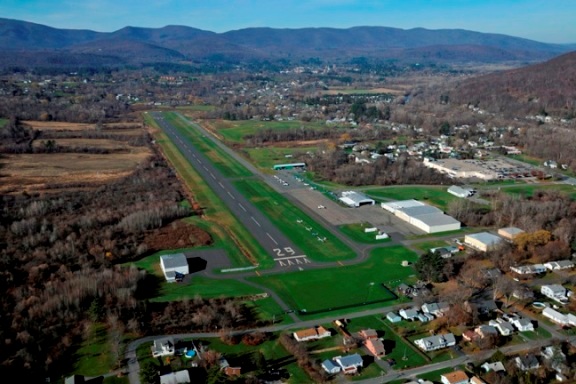
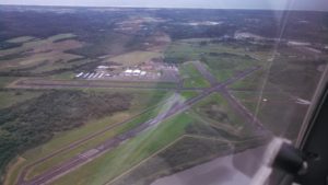
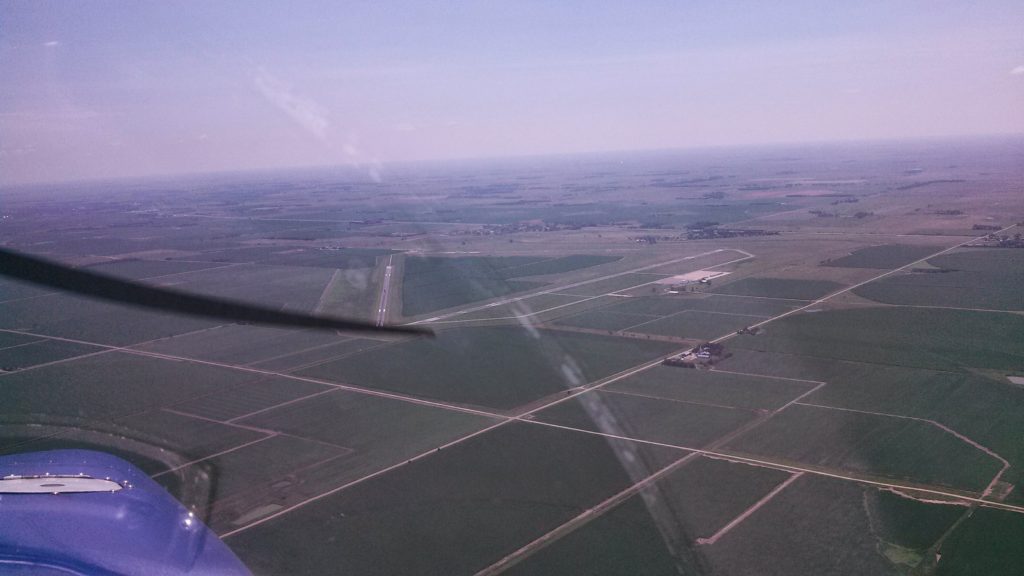
This airport is right next to a drag strip and from a distance it is hard to tell which one is the airport and which one is the drag strip as the are aligned almost parallel to each other. To be sure I overflew the field and then entered a right downwind pattern to landed to the south.
Nice folks at this airport. They charged me $5 a night for a tie down space. Fuel was reasonably priced, at least compared to other airports in the area. We stayed here three days visiting with the Wife’s family on Staten island.
My wife’s aunt really wanted to go for a ride in our plane. It seemed like a nice thing to do so I planned out a ride up the Hudson and back down. This time I was feeling much more confident in the trip and knew exactly how to handle the traffic and radio. We took off from Old bridge, turned north and came up the Hudson, flying on the right side (NYC) and got to see all the sights going north. We went all the way up to the Tappan Zee Bridge and then turned around and came back down on the Jersey side.
This time as we approached the Colgate clock I negotiated with the helicopter pilots and they let me get low and slow next to The Lady and I thanked them greatly for all their cooperation. My passengers really enjoyed being able to look Lady Liberty right in the eyes and take a picture of her. My wife’s aunt was quite funny. She asked me to go under the Verrazano. I did think about it for a moment but decided it was best to go over and not under.
We spent the next few days there on Staten Island visiting with family, cooking, eating and enjoying the summer weather. We had to delay our departure one day and perhaps it should have been two days.
Day 26 August 3rd
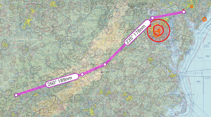
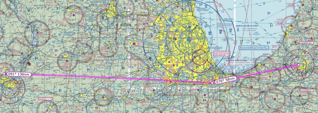
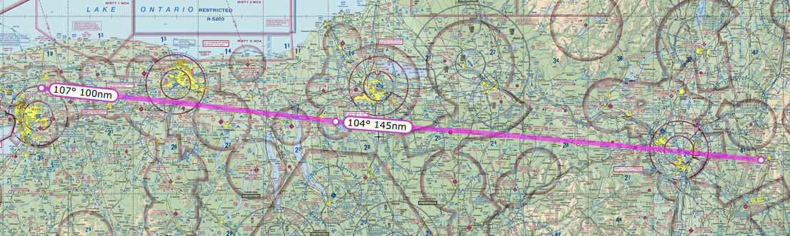
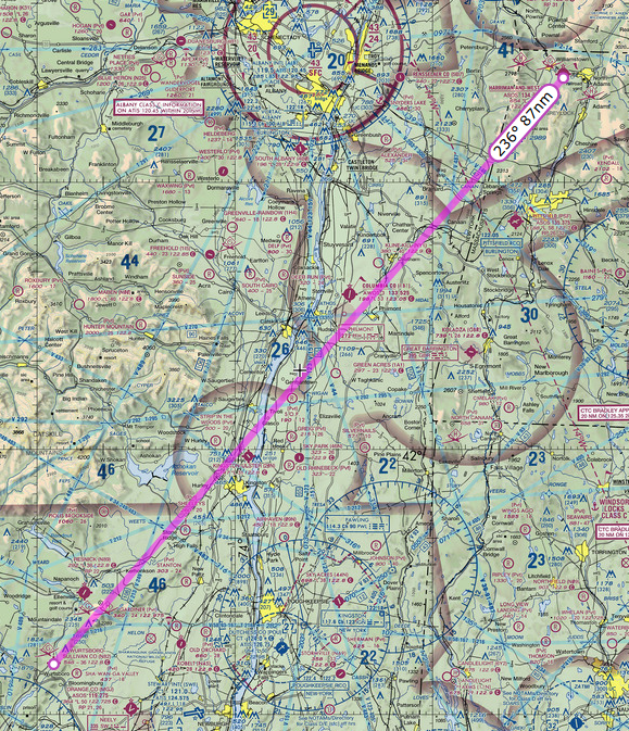
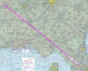
Today we departed Old Bridge New Jersey. The plan was to fly west on the north side of the Philadelphia airspace to the Pottstown VOR (PTW) then turn southwestward to the Westminster VOR (EMI) and then land at KGAI Montgomery County Airpark in Gaithersburg, Maryland to visit an old friend. I spent quite a bit of time over the previous days making sure I knew exactly what I needed to do to fly into the restricted airspace around DC. Essentially it came down to at a minimum being on flight following and making sure they knew we were headed towards DC.
The planned Route on SkyVector
The weather that day was reporting as marginal VFR for the entire route. Broken ceilings were forecast for an average of 1500 feet the whole way. The cloud layer itself was only predicted to be about 100 feet thick. Once airborne from Old Bridge airport, I contacted ATC and got on flight following and made my intentions to enter the restricted space clear. They understood and issued me a squawk code and asked me specifics of my route. I explained that we would head west to the Pottstown VOR PTW then southwest to the Westminster VOR EMI then south to KGAI. We were all set with ATC and continued our flight.
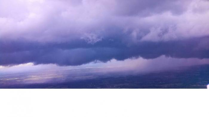
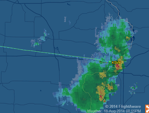
The ride underneath the clouds was pretty rough so I decided to climb above it at the first opening, which we did. This was going great and were were essentially VFR on top of mostly solid cloud layer at about 2000 feet. All was going great until we got a bit east of Philadelphia, just past the Pottstown VOR. A second layer of clouds formed above me at about 3000 feet so I was now between layers. This was not a problem as I could clearly see sky between them all along our route. At least until all of sudden they closed up and I was in the midst of a moderate rain storm in Instrument Meteorological Conditions (IMC).
I must admit I was caught off guard. The radar showed nothing and there were no rain storms predicted for that day. Also the weather conditions did not show a rain storm, at least not in the way I am used to seeing them. The weather that day was strange indeed.
I was not really worried about it as I have an instrument rating, but I am way out of currency. The storm however made things a bit hairy. So I radioed approach and let them know what happened. I instantly had the controller’s attention and he started helping me get back out. Turning back was not really an option as the clouds closed in around us and turning back would keep us in the same situation. I knew that the cloud layer ended at about 1200 feet so I reduced power, kept the wings level and began a slow descent out of the clouds. In the mean time ATC informed me that no airports along my route were VFR at this point.
Great! Now we are stuck. I asked for vectors to the nearest VFR airport. The nearest one was KILG New Castle Airport in Wilmington, Delaware. The rain was pretty heavy at this point and we were getting pushed around some by the wind. I informed ATC about the storm and they had no idea there was rain happening at that location. I was instructed to continue my descent until clear of the clouds and report field in sight. I did as instructed and then landed on runway 14 at KILG.
As we were taxing in ground control informed me that Philadelphia ATC asked for a contact number. I supplied one and expected I was probably going to get an arse chewing for flying into IMC conditions. We parked at the FBO and topped off our fuel. I again checked all the weather conditions, and outside of this storm, everything along my route from this point showed MVFR. I was perplexed.
We made an attempt to get out of KILG and finish our flight to KGAI but it was no good. Low lying clouds all about and there was no safe route out. So, we landed again and spent the night at a nice hotel. The Atlantic Aviation FBO folks were so kind. After arranging a special rate for us at a hotel, they even gave us a ride over and said they would come pick us up in the morning if we called. I give them five stars for customer service. We got a good dinner in town, a hot shower and a good night of sleep.
Day 27 August 4th
 The weather this day was much better. We departed KILG and headed for our fuel stop of KMKJ Mountain Empire in Virginia. I got on flight following as soon as I could with Pittsburgh and I am glad I did. When I was doing my morning flight brief I saw the usual TFR’s in effect around DC, but ATC would not let me go directly through, so I had to route around DC. One interesting point. After my request for flight following the Philly ATC repeated twice to me “Maintain VFR at all times” I had the thought that they might have flagged my tail number, since my incident with the storm the day before.
The Route on SkyVector
I want to give some kudos to a great little airport in VA called Mountain Empire. KMKJ. These folks are super nice. Stopped for refuel once before and the service was excellent. Full service fueling at a lot less than any other airport in a 50 mile radius. If you have reason to stop it is a great place. We borrowed the courtesy car and drove a mile south to a local eatery called the Red Barn Restaurant and had a nice home-cooked meal. If you ever get the chance to stop in, try the stuffed peppers.
After refuel we took off again and continued on our way to Crossville, TN. I picked up flight following and again ATC again made me read back to them “Maintain VFR at all times”. Okay I was getting a bit paranoid.
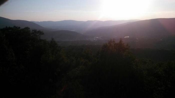
KCSV Crossville Memorial-Whitson Field Airport in Crossville, Tennessee was a great little airport for our stop. Fuel was reasonably priced, parking was free and the airport was well kept. On the flight into the airport I requested the runway 26 ILS approach, just for practice as the weather was clear, only to find out that the glideslope was out of service. Oh well. Lastly the terrain around the airport was spectacular to view. To the south was a ridge line, to the north was some beautiful rolling hills and east to west was a river valley full of green fields. What a great view.
We spent the next week there in Crossville visiting my father-in-law at his summer condo. We had a great time sight-seeing and trying some local cuisine. What a wonderful place with lots of beautiful scenery.
Day 38 August 13th
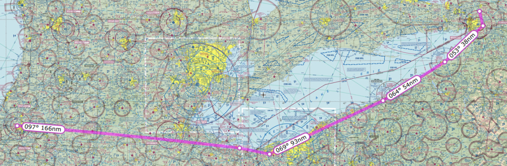
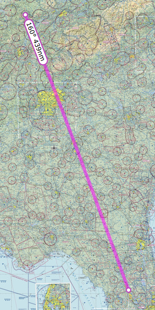 On this day we departed Crossville for our final journey home. The weather was partly cloudy in Crossville but the clouds were plenty high enough that I could see the mountain ridges well below them. We took off and started flying south. I attempted to get on flight following immediately with Atlanta Approach but the radio reception was very weak until we flew just south of the first mountain range by the Hinch Mountain VOR. Once over the mountain range, I was able to pick up with ATC and get on flight following. The planned route was direct from Crossville all the way to Leeward Air Ranch as we left our car there with some friends.
The Planned Route on Skyvector
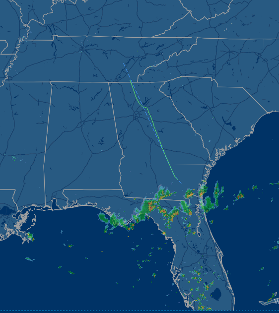 The route took us through the Atlanta airspace. I asked for clearance through the class bravo and was granted. ATC gave me a fix point to fly to and then continue south. I asked for it twice and looked it up but could not find it. The point kept coming up somewhere down in South America. So I told ATC I would just fly around, instead of through their airspace. As we got closer to the southern border of Georgia, I could see the storm clouds ahead. I looked at the NEXRAD radar on my Garmin 396 GPS and sure enough there was a line of large thunderstorms right across northern Florida. At this point I made the decision to make a rest stop and check out the weather situation. I contacted Atlanta and let them know we would be diverting to KAYS Waycross-Ware County Airport in Waycross, Georgia
The Waycross airport is a really great facility. They have a nice pilot lounge with comfy chairs and a good planning room with modern computers. We waited out the storms for a few hours to see if they would move off to the east enough for us to get around them. Since it was near dinner time we borrowed a courtesy car and went into town and got a nice meal.
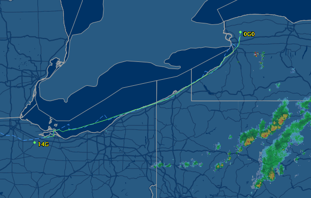
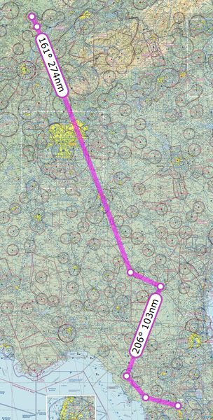 After we returned to the airport, I checked the weather again and the storms seemed to be dissipating some and no new ones were building behind them. We took off from Waycross and picked up flight following. The ATC at Jacksonville advised us that the best route around the storms was to turn east and fly to Cross City Airport KCTY, near the west coast of Florida and then fly somewhat southward until clear.
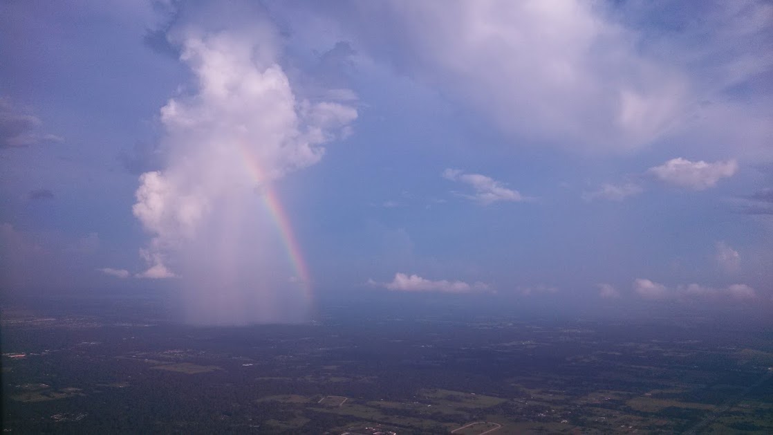
This seemed like a reasonable plan and so we headed out southeastward towards Cross City, which took us just outside the storm. In a strange way it felt good to see familiar cloud formations that were easier to interpret. I could tell exactly where the storm ended and where it was safe to fly.
 We proceeded south from Cross City past the storms until we were clear and then turned towards Leeward Air Ranch. As if not to be outdone, a single storm cloud was just east of Leeward and was dumping rain just west of the runway. This cloud was somewhat unique as it was dumping rain out if it’s side instead of the bottom. Fortunately it was far enough out of our way to make an easy landing at our destination.
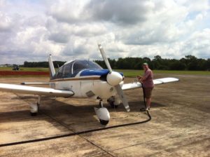
Piper Cherokee Landing 18 at Leeward
The numbers (Best Estimates)
Miles traveled: 6600
Hours of flying: 68
Gallons of Fuel: 680
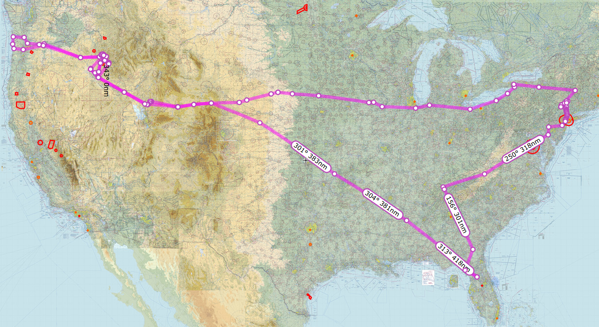
The Entire Route on Skyvector (Best Guess)

 After refuel we took off and had to deal with the Class C airspace right next door. What a pain! instead of letting me turn west then north I had to turn south then east then north and go all the way around.
 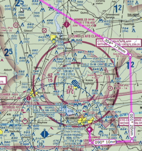 Quite frustrating but I understood afterward that had I gone east then north I would have ended up right in the middle of the approach path for incoming flights. We finally got back on track with flight following and continued to KMIO Miami Municipal Airport located in Miami Oklahoma. Quick note Miami is pronounced “my-am-a” at this particular location as it is a Native American word.
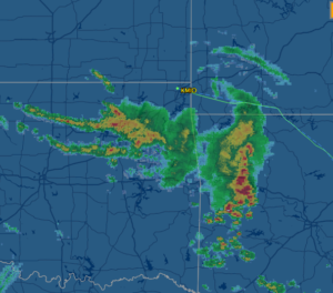
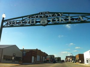 It swayed and rattled but ran just great and got us to dinner and our hotel just fine. We had a great dinner at Montana Mike’s and then cruised Historic Route 66 in the courtesy car. While on Route 66 we saw a bunch of restored landmarks including an old gas station, a theater and several shops along the way.
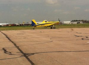 The airport itself was located in the middle of acres of corn fields. The runway seemed to be made of a series of cement tiles connected together, which made my tires click out a tune as we landed. I picked this airport because it was on our route and had some of the least expensive 100 octane low-lead fuel, commonly called 100LL for the plane. Our Piper Cherokee burns about 8 to 10 gallons of fuel in an hour and goes through 40 gallons every four hours of flight. Finding less expensive spots to stop for fuel really saved us some cash.
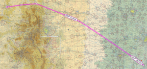
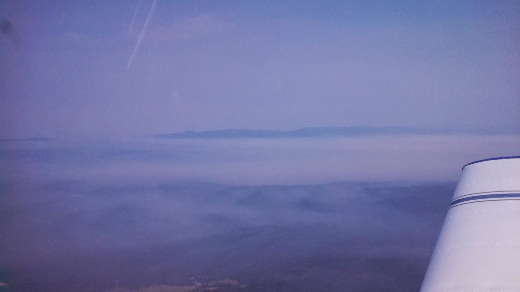
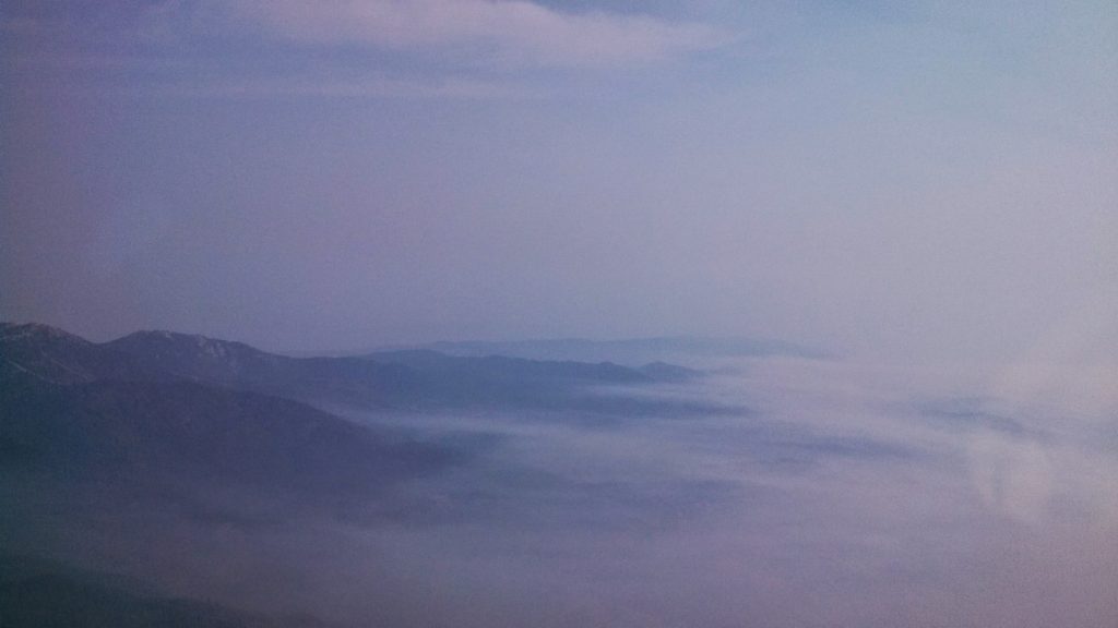
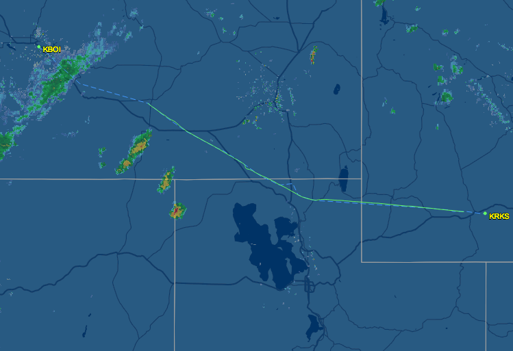
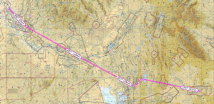 Took off from KRKS Rock Springs early morning and had a very slow climb out. Density Altitude (DA) was already 2000+ at 8:00 am. The field is 6765 feet so DA was 8765+ feet at takeoff. With full fuel and 60 lbs under max weight, we rolled down the runway almost 5000 feet and then climbed ever so slowly at 50-100 feet per minute (fpm). At sea level a normal climb for this plane even fully loaded is around 500-600 fpm. This poor climbing performance made me a bit nervous because the mountain ridge ahead of us was about 8300 feet high. Slowly got to 8500 to clear the mountain ridge, then lowered the nose and flight-climbed to 10,500 feet.
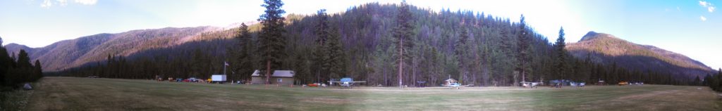
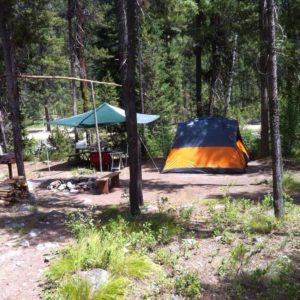
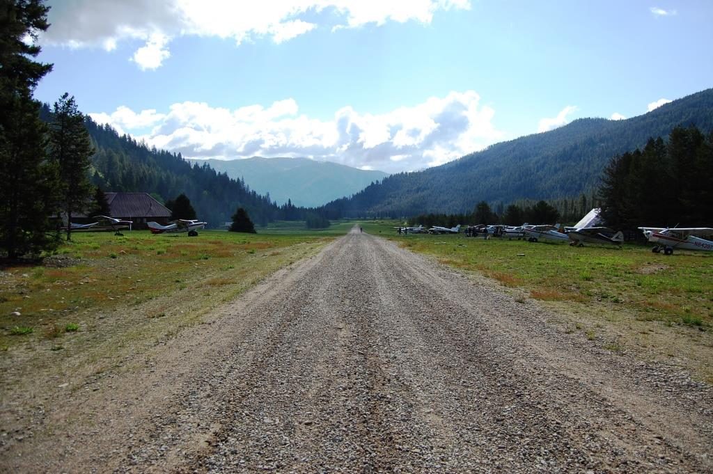
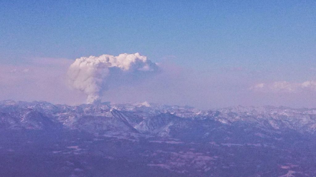
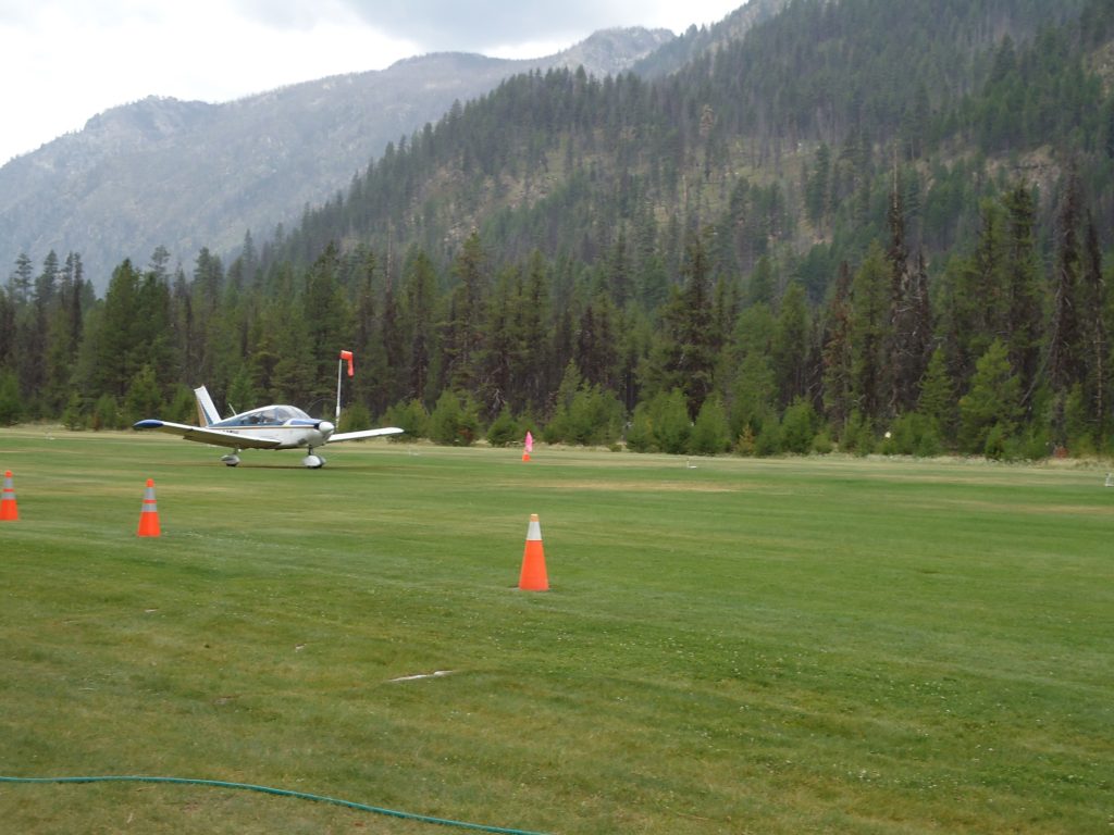
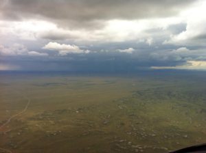
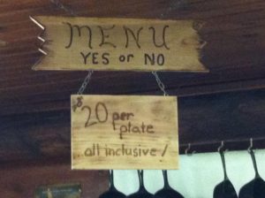 a bit of haze during the flight in that we later discovered was smoke. The breakfast menu is very simple. Yes or No. The food was fantastic. The breakfast consisted of eggs, pancakes sausage, home-made apple butt and piping hot coffee. We were able to sit outside and watch other planes come in and land on the runway.