Planning the Route
Much planning and discussion of the route for this trip took place for weeks before the actual event. I discussed the route with several other pilots and finally came up with what was considered a safe and survivable route.
The numbers (Best Estimates)
Miles traveled: 6600
Hours of flying: 68
Gallons of Fuel: 680
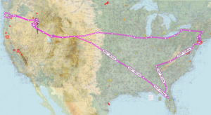
The Entire Route on Skyvector (Best Guess)
A Few Words on Back-Country Flying
My original flight training took place in the western mountains of Massachusetts, so I had some relevant experience with flying around and understanding the weather phenomena that occur in mountainous terrain. I did however recognize, that the mountains were much higher and the risk was greater in the Idaho back country. I devoted quite a bit of time to reviewing everything I could find about flying into the Idaho back country and more specifically, Johnson Creek airport. I read pamphlets, web articles and watched many videos on the subject. I also started obsessing about the weather about two weeks before we departed so I knew the weather patterns well.
One video that was particularly well done and very informative is this one by Greg Swingle:
I feel these factors, good route planning, studying up on back country flying, and knowing the weather patterns were essential to the success of the trip. Having a backup plan was also very useful. I had a plan A, B, C and sometimes D for each leg of the trip.
Day 1 July 10th
We loaded the plane to within 60 lbs of gross and headed off northwestward. The basic plan for getting to Johnson Creek was to fly four hours, refuel and then four more hours before stopping for the night. Out first planned stop was M83 McCharren field for a quick refuel and stretch break. I picked up flight following just after lift off. For the next four hours they were a constant companion in my headset.
The flight went well until we got close to our destination. I was turning east, then west, ascending and descending to avoid the rain clouds that popped up. About fifty miles from our planned stop at McCharren, I realized we were getting low on fuel. When I state that we were low, we were down to the FAA safe minimum of 30 minutes remaining fuel. I changed plans and went to the closer planned alternate of KUBS Columbus-Lowndes County Airport in Mississippi.
KUBS was a nice stop. The FBO was in the midst of a face lift and a crew was working on the interior. The bathrooms were clean and in good shape and they did have a nice little pilot lounge in the making. 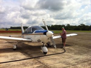 After refuel we took off and had to deal with the Class C airspace right next door. What a pain! instead of letting me turn west then north I had to turn south then east then north and go all the way around.
 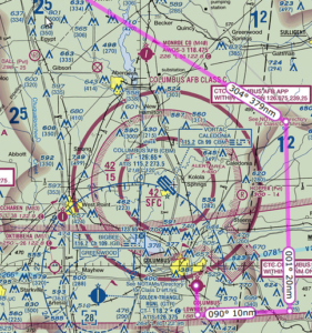 Quite frustrating but I understood afterward that had I gone east then north I would have ended up right in the middle of the approach path for incoming flights. We finally got back on track with flight following and continued to KMIO Miami Municipal Airport located in Miami Oklahoma. Quick note Miami is pronounced “my-am-a” at this particular location as it is a Native American word.
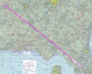
Link To The Route on Skyvector
Had a few moments of excitement on the way in to KMIO. Encountered some moderate rain and approach guided me around the worst of it. Went through about 4 miles of downpour that brought visibility way down. 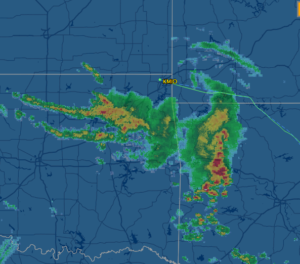
Oh! The best part. The runway at KMIO is closed for repairs. I saw the NOTAM during my morning flight brief on DUATS and called the airport to confirm. The airport manager let me know there was no issue and he instructed me to land on the taxiway. No problem!
NOTAM: MLC 08/194 MIO RWY 17/35 CLSD PARL TWY 4000FT X 50FT AVBL SR-SS VMC 1408121402-1408261400
What a wonderful place. There is one of the longest restored sections of Route 66 running right through the middle of this town. When I called ahead about the runway I also asked about a courtesy car and the manager arranged one for us. Our ride was a big old Ford Crown Victoria that was a retired police car. 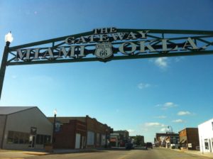 It swayed and rattled but ran just great and got us to dinner and our hotel just fine. We had a great dinner at Montana Mike’s and then cruised Historic Route 66 in the courtesy car. While on Route 66 we saw a bunch of restored landmarks including an old gas station, a theater and several shops along the way.
Day 2 July 11
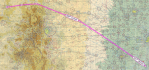
Departed KMIO picked up flight following and flew to our planned refuel stop, Imperial Municipal Airport KIML located in Imperial, Nebraska. We got a great tailwind, which is unusual when traveling west.  The airport itself was located in the middle of acres of corn fields. The runway seemed to be made of a series of cement tiles connected together, which made my tires click out a tune as we landed. I picked this airport because it was on our route and had some of the least expensive 100 octane low-lead fuel, commonly called 100LL for the plane. Our Piper Cherokee burns about 8 to 10 gallons of fuel in an hour and goes through 40 gallons every four hours of flight. Finding less expensive spots to stop for fuel really saved us some cash.
Link To The Route on Skyvector
The next leg took us from KIML to KRKS Rock Springs – Sweetwater County Airport in Rock Springs, Wyoming. This was the big moment where we flew up to and then across the Colorado rocky mountains. I had thought about this moment quite a bit as I would be flying at 10,000 feet, yet I would only be a few thousand feet above the ground as the peak elevations here would be around 8000 to 9000 feet. Fortunately the northern route afforded us plenty of vertical clearance and an wonderfully scenic flight path.
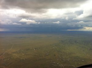
While on flight following we got treated to ATC rerouting several flights due to heavy precipitation over Denver. We stuck to our flight plan of MBW to CKW to OCS which kept us out of the rain. Here is a pic of the storm over Denver. It was enormous.
The ride into the mountains was turbulent. I was stuck below a near solid cloud layer at about 10,000 feet and bumped along all the way to KRKS. ATC lost us on Radar for a while between Medicine Bow and Cherokee, but picked us back up as we got closer to Rock Springs. Interesting note about the runways at KRKS the 09\27 runway is huge! (10,000 x 150 feet) I hesitated for a moment and had to check the sectional to confirm the runway altitude to set my pattern altitude.
Link To The Route on Skyvector:
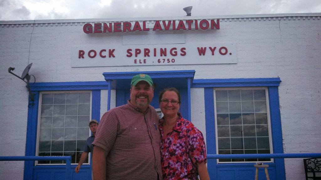
The hospitality here was great we were warmly welcomed and chatted it up with the locals about flying conditions on the way in. Got a ride from some nice folks to our hotel. The following day we planned our travel to S75 Payette.
Day Three July 12th
 Took off from KRKS Rock Springs early morning and had a very slow climb out. Density Altitude (DA) was already 2000+ at 8:00 am. The field is 6765 feet so DA was 8765+ feet at takeoff. With full fuel and 60 lbs under max weight, we rolled down the runway almost 5000 feet and then climbed ever so slowly at 50-100 feet per minute (fpm). At sea level a normal climb for this plane even fully loaded is around 500-600 fpm. This poor climbing performance made me a bit nervous because the mountain ridge ahead of us was about 8300 feet high. Slowly got to 8500 to clear the mountain ridge, then lowered the nose and flight-climbed to 10,500 feet.
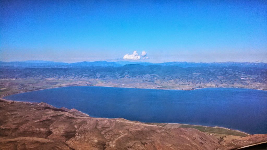
One part of the flight that was particularly scenic was the trip over Bear Lake.and through Logan Pass. We flew west towards and then over Bear Lake to the lakefront town of Garden City.
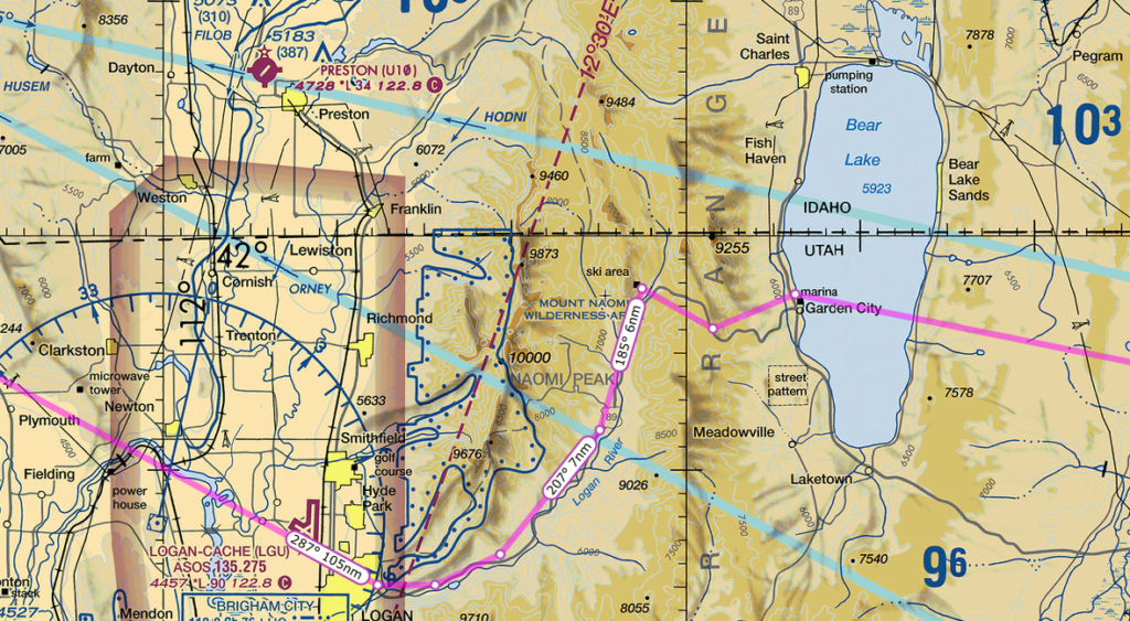
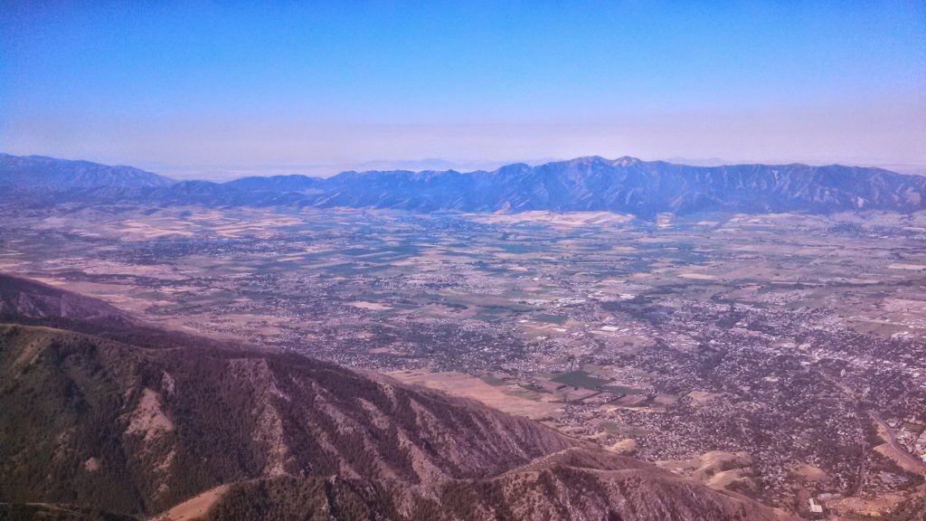
Once over the lake, we then followed the highway past Garden City to the west through the mountain pass into Logan Utah. Really something to see as we approached Logan and the mountain pass made a dramatic drop off a few thousand feet down into the valley where the city of Logan resides.
Link To The Route On Skyvector:
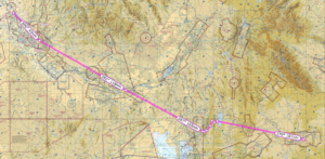
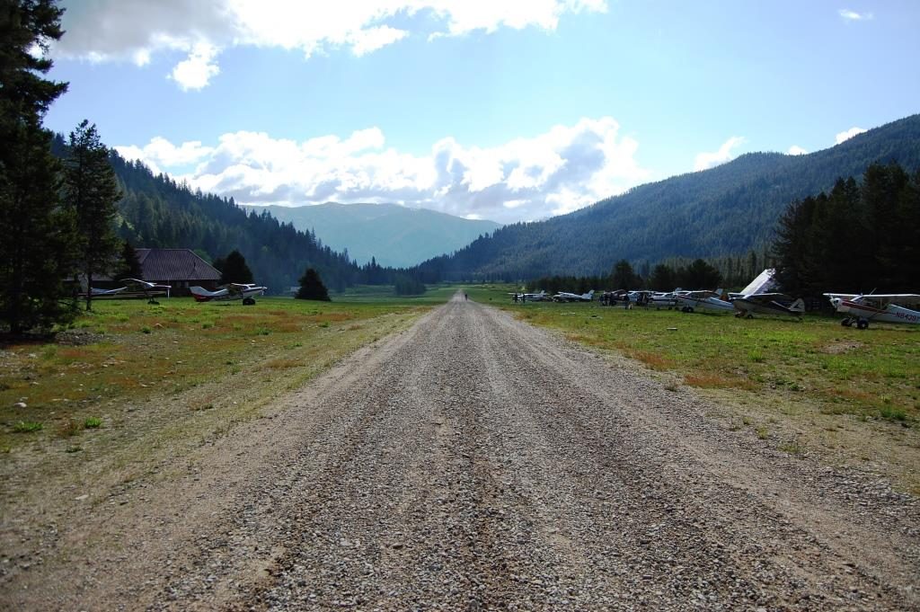
We continued our flight over the BYI to BOI VORs and then started our decent to S75 – Payette Municipal Airport in Payette, Idaho. Payette is a great little airport with friendly folks. They had the best price on Avgas, also offered 91 octane Mogas, and had a nice courtesy car. I made a bit of a bumpy landing coming in from the south as the rough terrain around the airport produced some turbulence.
I was a little worried about the climb out in the morning. We planned to take off early to the north for that slow climb up to altitude. The following day was the arrival at Johnson Creek.
Day Four July 13th
We set out early from our hotel, drove the courtesy car back to the airport and departed from Payette. Actually had no problem at all taking off as Payette is 2228 ASL and the morning air in the valley was cool with no wind.
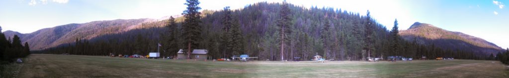
For our first landing at Johnson Creek Airport I chose the southern approach. That means I flew southeast from Payette, over Emmett field – S78, turned northeastward to horseshoe bend, then north along the railroad track up to Cascade airport. After that I turned northeastward and followed a road through the notch in the mountain range until I intercepted Johnson Creek. From there I turned north and followed the valley right into Johnson Creek Airport.
A brief note on landing at Johnson Creek. The preferred landing runway is 17 as the runway has a 10 degree upwards slope to the south. The canyon walls top out at about 8900 feet ASL but the runway is 4933 ASL. That means you have to fly the pattern at about 5900 feet very close to the runway. When approaching from the south you have to fly the downwind leg very close to the runway and very close to the trees in the canyon. For a first-timer this was intimidating! I found myself watching the trees and the altimeter and struggling to find the altitude that felt safe.
The landing pattern cannot be squared out like we might do back at home. I flew the plane north bound past the field to what is designated as the widest part of the canyon. At this point did a descending 180 degree turn to the left as I added flaps. This did not allow me to descend enough and I was high on final. This is a common rookie mistake. When I was abeam the numbers I should have been a maximum of 800 feet above the runway, however those trees looked really close at that altitude and I opted to stay a bit higher. To make the landing I did a side slip and held it almost all the way to the runway. My first landing was a bit steep and fast, but the runway is 3400 long so I had plenty of space to let the plane roll and burn off speed.
A couple of other points to consider. I was moving way faster in that thin air. Although my airspeed indicator said 70 knots it was in reality closer to 80 knots over the ground. Things happened fast. The direction of the wind through the canyon that day also created an updraft on my downwind leg. I was reducing power and still climbing. I had to push the nose down and reduce power quite a bit to get down to pattern altitude.
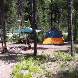
Once we landed at Johnson Creek. We camped for the next week. The daytime temperature was almost 100 degrees, at night the temperature would descend to about 45 degrees. This made for some cold nights. The good news is that there is a shed full of extra camping gear left behind and donated by other campers so we were able to find some extra sleeping bags!
The scenery here is breathtaking. The mountains are tall and steep and lush with green. The valleys are spectacular as they are full of life and beauty
Our campsite next to the river with all the comforts of home.
Day 8 July 17th
On this day we went to Sulfur Creek ID74, pronounced “crick”, for the famous $20 breakfast. Had 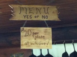 a bit of haze during the flight in that we later discovered was smoke. The breakfast menu is very simple. Yes or No. The food was fantastic. The breakfast consisted of eggs, pancakes sausage, home-made apple butt and piping hot coffee. We were able to sit outside and watch other planes come in and land on the runway.
My landing was a bit of an adventure as I think I hit a gopher on landing. Look and see:
Sulphur Creek is a fly-in resort with lodge and cabins. The price to stay there was a bit steep, but you do get all your meals included plus a warm comfy bed in a cabin. After freezing a few nights I was tempted to plunk down the cash for a warm bed!
Remember when I mentioned back on day 1 where we flew through some precipitation near KMIO? Well, it seems that precipitation included some very abrasive droplets. The propeller on the plane was stripped nearly clean of all paint on the back side. I made arrangements with a prop shop in Boise Idaho to fix my prop and re-balance it.
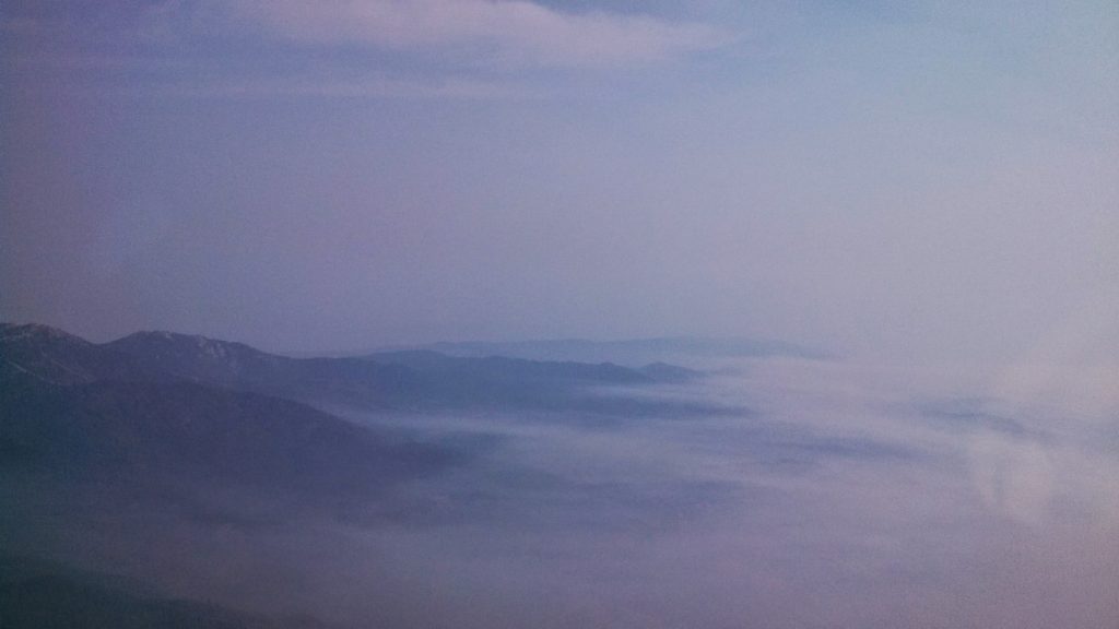
On the flight south from Sulfur Creek we flew to KBOI Boise Air Terminal/Gowen Field Airport to get the prop re-balanced. As we traveled south towards the airport the valleys were filled in with smoke and only the very peaks of the mountains were visible.
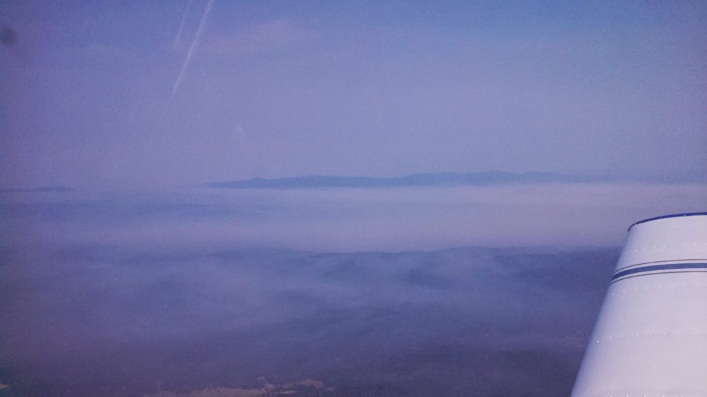
It was a strange experience to see the mountains this way, as only a few days earlier we saw them quite clearly. This also significantly reduced visibility. As I got closer to Boise I estimate I could see about 3 miles in the smoke, sometimes it was even less.
As I got about 20 nm from KBOI, I radioed approach to gain access to the Class C airspace. I was denied and was told to hold outside the airspace. I ended up flying a little racetrack pattern for about fifteen minutes while I waited. I was then granted svfr access and given a specific altitude and vector to fly. I did not see the actual runway until it was very close. Approach guided me to a left base for runway 10R and then turned me over to the tower.
The local prop shop kept my plane overnight and the wife and I spent the night in a local hotel. I slept almost 12 hours as sleep out there in the woods was not as warm and restful as I had hoped.