Day 9 July 18th
We flew back from KBOI to Johnson Creek in the evening. It is OK to fly in the morning up until about 1 pm and then again after about 6 pm. I was not aware that just about this time in the evening the winds start shifting from the south to the north. In fact, the wind often gusts during this time.
I got my first taste of a downdraft & tailwind mixed together. While flying the downwind leg for 17 I observed that the windsock was hanging still. So I continued and planned to land runway 17. As we turned final for 17 and descended I had power all the way out to help with descent as I was again a bit high. All of a sudden we got pushed hard from behind and the nose dropped and the plane accelerated. I went max power and started climbing out for a go around. As luck would have it, just about that time the constable from Yellow Pine, the village north of the field, was passing by the field and I guess I flew over his vehicle close enough to make him take notice. He stopped by the airfield to make sure everything was OK. I ended up landing 35 this time as the wind was strongly out of the north.
Day 11 July 20th
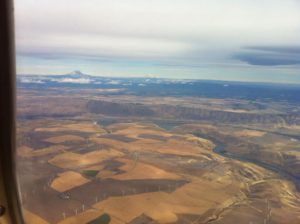
Today we flew from Johnson Creek to Tillamook Oregon via the Columbia River. This route is often called “The Gorge” We departed Johnson Creek early in the morning and used the northern pass out of the mountains and flew over to McCall to refuel. We then headed out to the west going to the Baker City VOR BKE and the northwest to the Klickitat VOR. From this point on I was following the Columbia River. There was a cloud cover at about 1500 feet which required me to drop down below what flight following could track me so we dropped off flight following and went VFR.
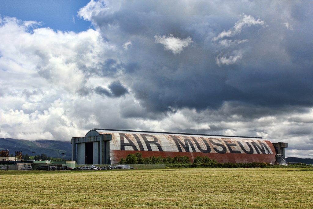
We needed fuel and the recommended stop was 4S2 – Ken Jernstedt Airfield Airport in Hood River, Oregon, referred to as “Hood River” by the locals. This was a very challenging landing as the wind was gusting at 20 knots down the runway. I also found out that there is a huge museum right behind this airfield called Western Antique Aeroplane and Automobile Museum that we missed.
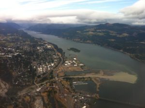
After we took off and proceeded west, I contacted Portland Approach and we stayed on with them as far as we could. They were really nice and let me cut through the Class C airspace a little north of the airfield and river.
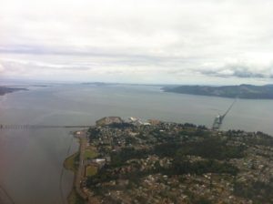
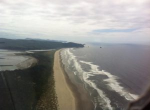
The cloud layer was pretty low at this point and we flew along under it at about 1000 feet using the Columbia River as our guide. Then we emerged out from under the clouds and we were almost to the coast. We flew over Astoria Regional Airport, and then turned south down the coast to Tillamook.
Sadly the museum did not live up to the hype. The museum owner had some dispute with the aircraft collection owner and he pulled all his airplanes out of the museum. That was really disappointing. There were still some really cool planes, but I did not get to see all the one I hoped to see.
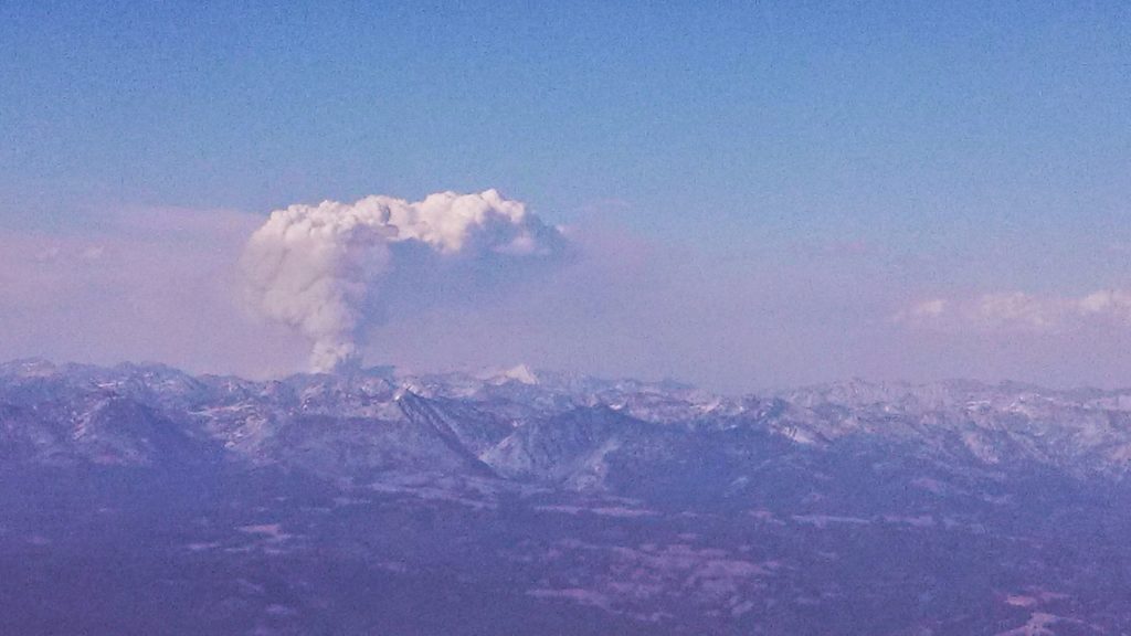
Flying back was pretty much uneventful. Once clear of the low clouds, we bobbed along at about 9500 most of the way. We did get to see something very unique. There was a forest fire burning north of our route and it looked like a volcano erupting from the middle of the woods.
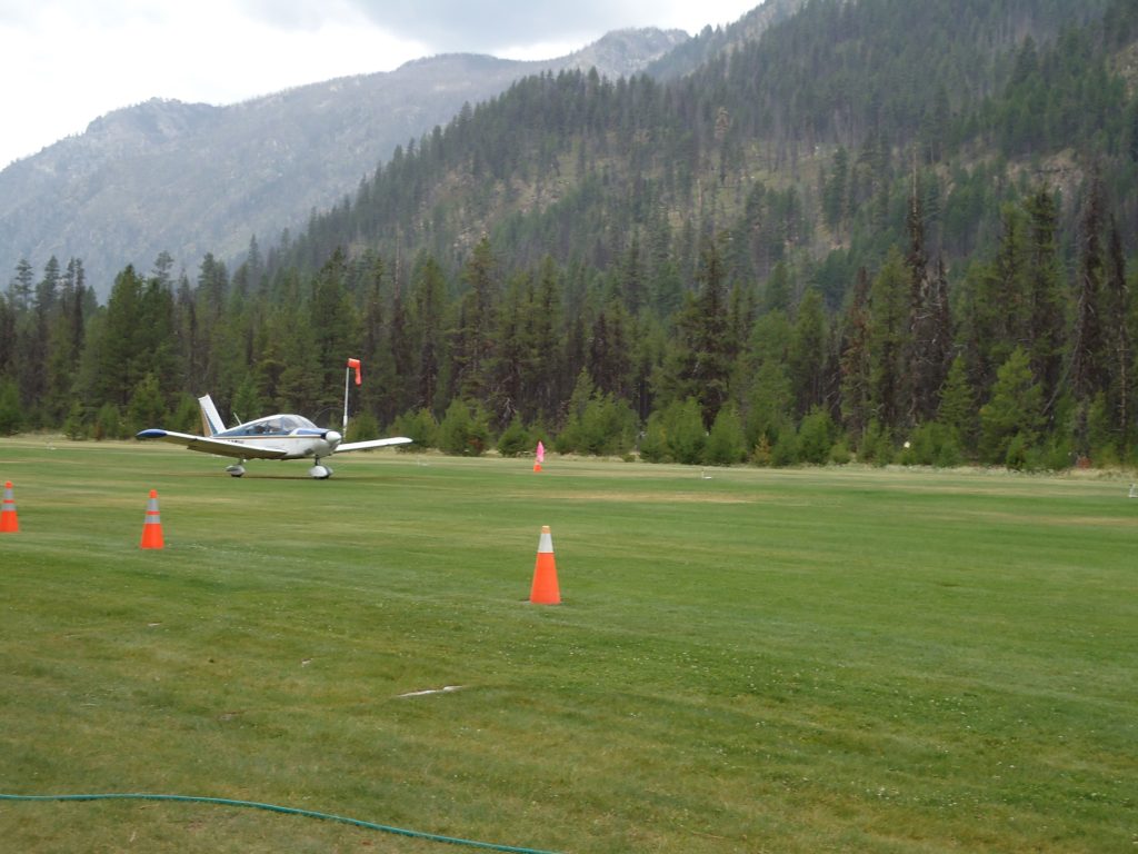
On this trip we flew to the north side of Johnson Creek and came into the airport through the northern pass, which starts just east of the McCall airport. There is a road which follows the river all the way from the town of McCall into Yellow Pine. I wish I had video as the experience of flying through this route was spectacular, however my camera operator and wife did not enjoy the experience as much as me. We were flying at about 6500 feet with peaks all around us and narrow deep valleys This made her a bit nervous. This landing at Johnson Creek was uneventful. This was out last night at Johnson creek and we planned to depart and start heading east.
Day 12 July 20th
This morning we departed from Johnson creek and flew to Rock springs. It was sad to go as we had such a great time there. The care takers Phil and Roxie are some of the best folks I have ever met. They really do a great job keeping that place clean and running smoothly.
I want to mention my death defying takeoff, not to brag but as a learning point. We were 200 lbs under gross weight and the time was 7:30 am and density altitude was 5900. I had to do a combo soft field into a max performance takeoff just to clear the trees. I will admit it frightened me when I had to yank the plane into the air and then ride just above stall at about 50 fpm. Then slowly and I mean ever so slowly creep over to the canyon wall and use the updraft to gain altitude.
Once we got going and I calmed down from the takeoff, the rest of the flight was good. We flew south out of the mountains and made one last stop at Payette S75 for a full tank of that inexpensive mogas. We picked up flight following as we traveled southwest towards Biose and I am glad we did. They were able to help us get around some rain storms on our intended path.
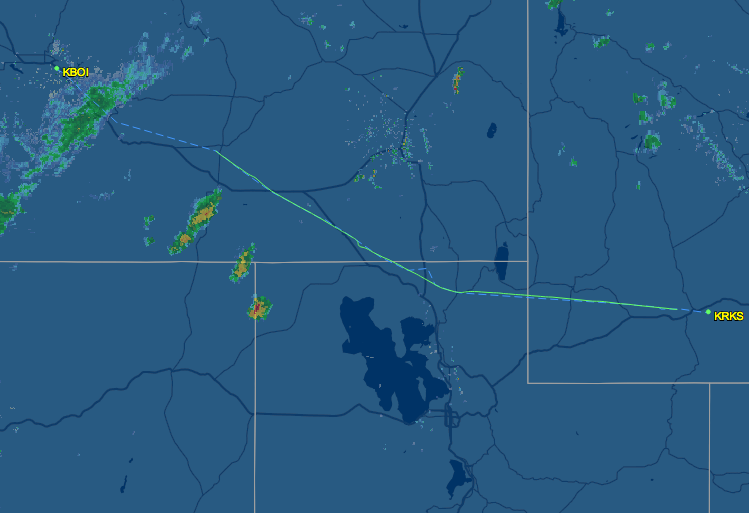
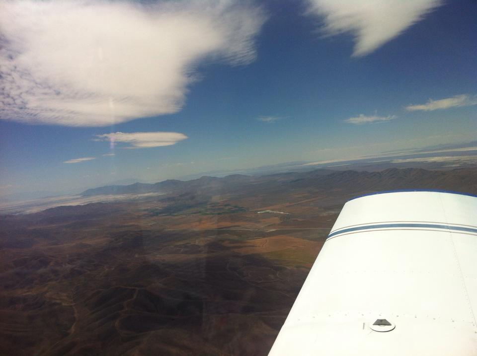
Once we got past the rain in Boise the skies were clear and the tail wind was something! I tried to keep an average altitude of 10,500 but that was difficult due to the lumpy air. Air speed indicator showed about 90 knots. The GPS showed a ground speed of about 120 knots! Must admit it was a bit rough going and my arms were tired from fighting the turbulence. We did however, get a nice look at Salt Lake Utah in the distance as we headed back to Rock Springs.
This time our landing at Rock Springs was on that huge runway 27. I had to keep telling myself that I was at the proper pattern altitude because the runway was so big and it looked too close.
Day 13 July 21st
We spent the night in Rock Springs at the Holiday Inn Express and then flew out early in the morning. I knew that the takeoff would be a very slow climb so I was prepared for it. I did not use flaps and just let the plane roll down runway 27, it is plenty long, until it was ready to fly and then slowly climbed up. Going east was much easier as there is no steep mountain to clear and a nice open valley to follow along through the mountains. I essentially followed highway 30 all the way out of the rocky mountains.
Once we exited the rockies, I flew almost due east then turned slightly northeastward to our refuel stop of KANW Ainsworth Regional Airport in Ainsworth, Nebraska. One interesting fact about this little airport is that the FAA has a big office here and I believe several flight service folks work at that office. However I did not see them as they were behind locked doors. The FBO did have a really nice pilot lounge and some really comfy couches, which made for a nice snack break.
Ainsworth Regional Airport was just about on the edge of the terrain change. Once east of this airport everything started getting greener, and a whole lot closer to sea level. I was able to fly at lower altitudes and get bounced about much less.
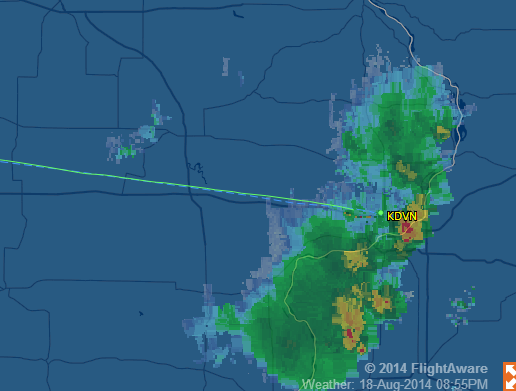
From Ainsworth Regional Airport we continued east at a considerable speed, we got a 30 knot tail wind for an average of 140 kts ground speed, to our evening stop of Davenport Municipal Airport in Davenport, Iowa. We did encounter a few light rain storms that forced some course deviations on the way to our next stop. As always I was on flight following and they were a big help. They even asked me for a few PIREPS as we passed close to a few of the storms. I thought it was cool that many other pilots got to benefit from my sharing about the storms, their intensity, tops and bottoms and the air conditions around them.
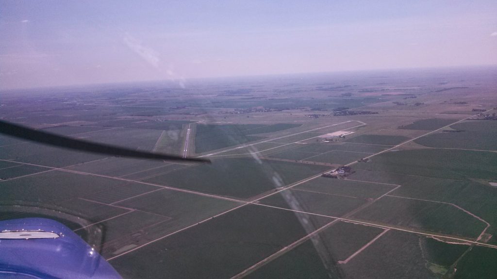
The landing at Davenport was a bit of a challenge. There were storms in the areas and the wind was a right quartering cross-wind gusting at about 17 knots. I really had to work hard to get the plane down safely on the runway.
I had my right foot all the way down on the right rudder and it was still not quite enough to keep us straight. I added 8 knots, half the speed of the crosswind, to my airspeed so I was landing at about 78-80 knots. With that extra speed I had to work a bit harder to get the plane down to the runway. In the video you will notice my hand on the dashboard. That was to help keep me steady as I fought the crosswind. After landing you will notice that we get pushed to the left and I have to steer the plane back to the center.
The folks at Davenport were super nice. Since I bought gas and planned to spend the night, they loaned us a crew car to take to our hotel. This car was a couple of notches above the average courtesy car we normally use. This was a super nice, late model American sedan with plush leather seats and super good A/C. Another amazing bonus was a Cracker Barrel restaurant right across the parking lot from our hotel. As luck would have it we had a gift card for Cracker Barrel and feasted like kings!