I am sure that many of you have seen this article about the Perfect US Road Trip. I really enjoyed the article and recommend giving it a read. Lots of great suggestions for places to visit and things to see.
The Perfect US Road Trip
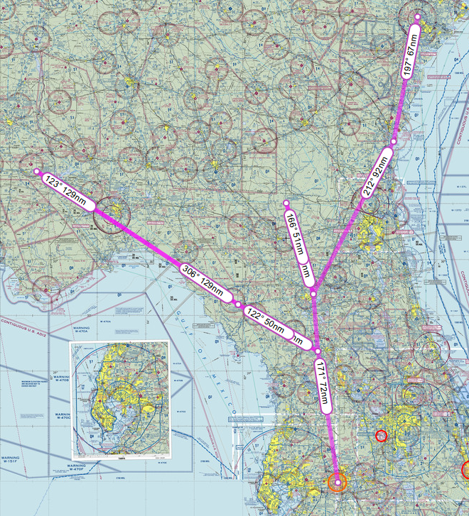
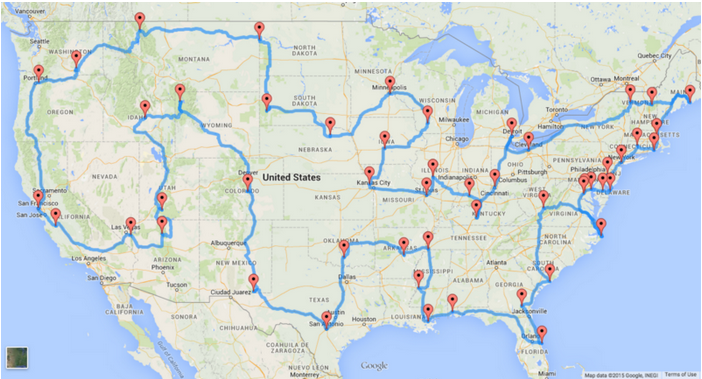
After reading it, I got an idea. What if I did this same trip in my airplane? I pulled up the road map provided in the article and starting matching it up to airports using the SkyVector website. Lo and behold, nearly every place mentioned has an airport nearby. In some cases right next to the site. I created a flight route that nearly mimics all the locations provided in the perfect trip and to be honest it looks quite possible. Maybe a few adjustments for getting over mountains and around some restricted areas but, otherwise very possible.
I used airnav.com to help me find airports close to the sites. When selecting airports I tried to go with local or municipal airports that had FBOs that could get a rental car or at least provide a courtesy ride to a local hotel. In nearly every case fuel and hotels were available within a short drive, if an overnight stay was needed. Mind you, not every place had a five star hotel with every amenity, but most had inexpensive motels within a short distance. I did not really focus on finding the least expensive fuel, just that the airport had fuel available or a close by airport had fuel. I am sure a thrifty pilot could use airnav.com to check local fuel prices and adjust the route to save a buck or two on fuel.
Could this route be optimized to be more direct? Yes it can. The goal here was to match the road trip as close as possible. That way even if you don’t land in every state you at least get to fly over and see them from the air. Another benefit is that you can fly over all those commuters on the highways below, open your window and shout at them “Where is your plane, peasants!”.
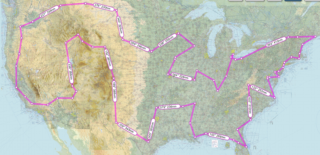
Perfect US Flying Trip
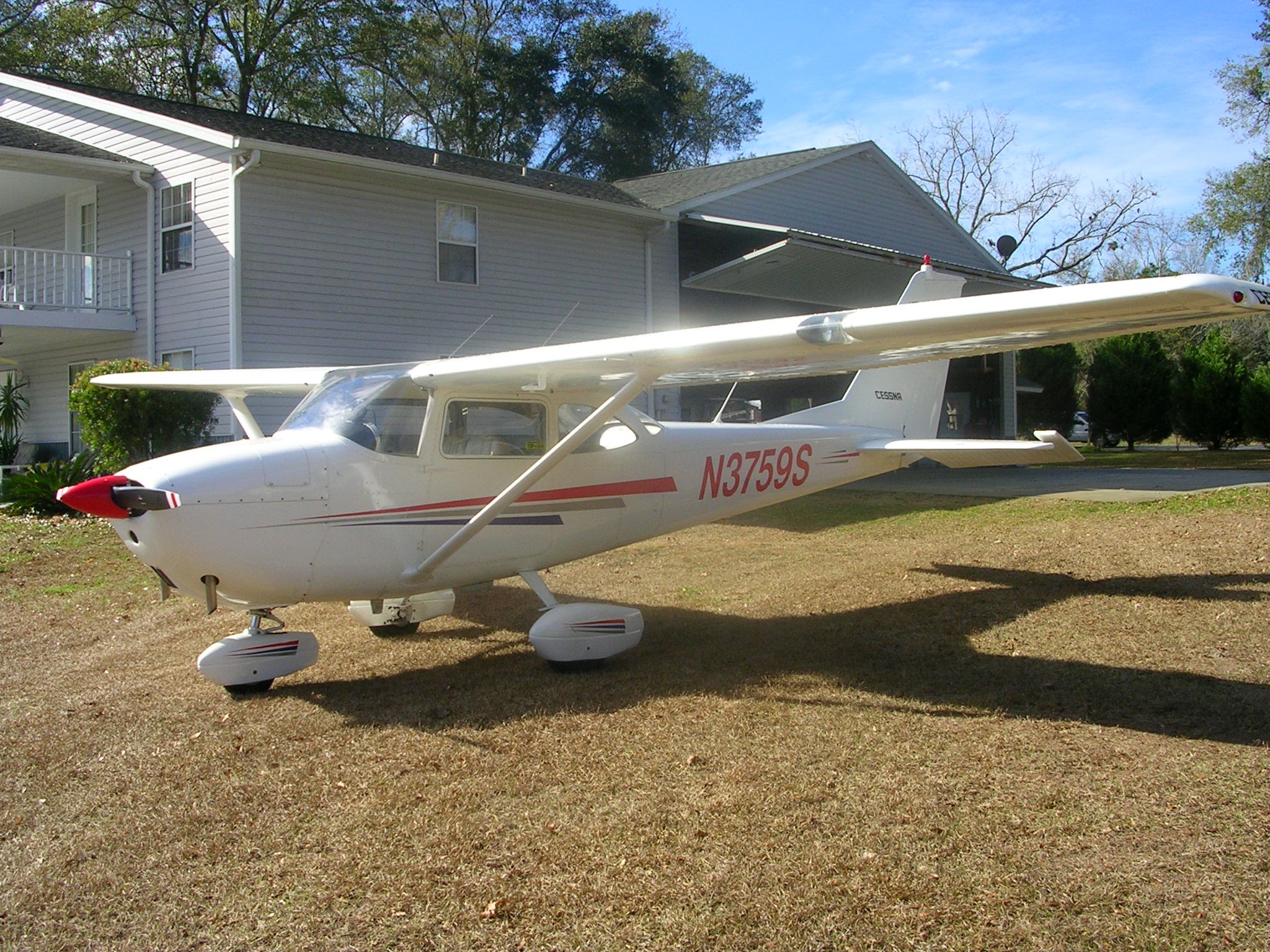
Rudy the Red-Nosed Cessna 172
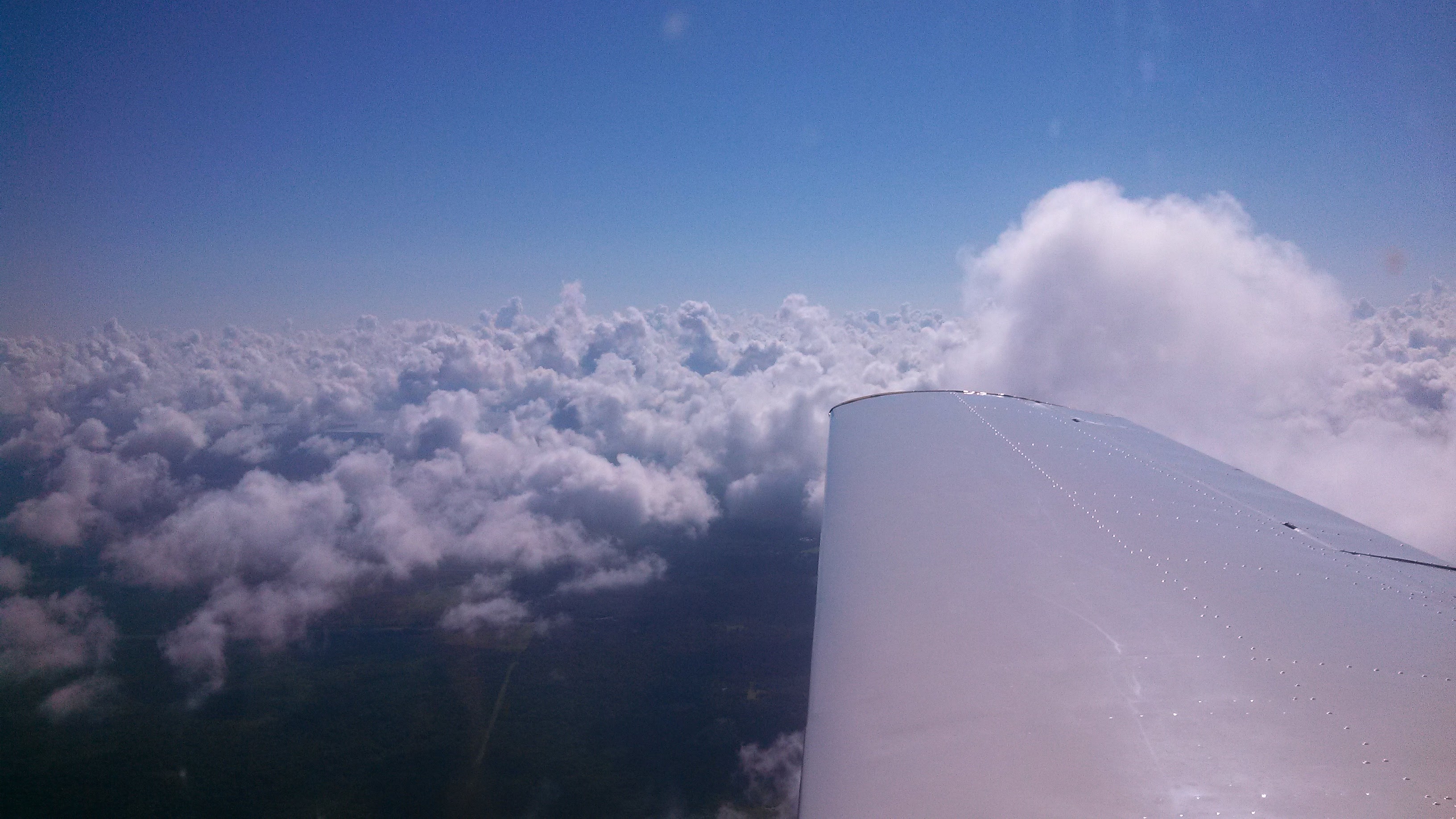
As this is supposed to be a sight seeing trip I chose to plan for flying my 1964 Cessna 172E. This will be a low and slow flight focusing on maximum visual enjoyment. This plane consumes about 6-8 g.p.h and goes about 105 knots (or 120 mph) on a calm wind day. The trip would cover 9673 nm, take 91.5 hours of flying time and consume at least 778.3 gallons of fuel. Some of the legs would be right at the maximum range with safety, and to be honest I’m not sure my backside or bladder could make it that far without an interim stop. On some of the legs slight left or right deviation would be advisable to avoid those pesky tall mountains, but none of it is impossible.
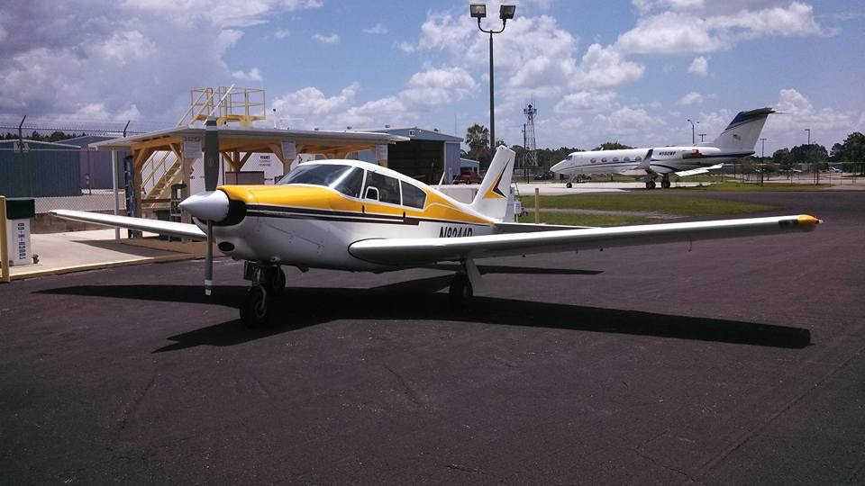
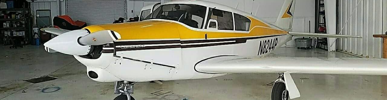
Sunny Side Up the World’s greatest Piper Comanche 180
If I did this trip in my Piper Comanche, slightly different numbers. 80.5 flight hours and 804 gallons of fuel. For sure I would be more comfortable, I could fly further and get there quicker. However I think the point is to take it all in, so low and slow would be optimal so a simpler craft would be best.
The cost for this trip by aircraft will be a bit higher than driving. The biggest expense will be fuel. Based on the regional prices of Aviation Gas 100LL from the www.100ll.com website the average price for a gallon of fuel in the US right now is $5.09 per gallon. Therefore 778.3 gallons of fuel would run about $3692 in fuel. Most FBOs will waive overnight parking fees with a fuel purchase so that is a money saver. My 172 has a MoGas STC, which means I can burn unleaded car gas that does not contain ethanol, so I might even save a few more dollars.
Another expense will be an oil change. With just under 100 hours of flying time at least one oil change will need to be done. A shop might charge an hour of labor and the cost of the filter and oil. Probably best to budget $200 for that activity at about the half way point of the trip. Perhaps this oil and filter could be prepositioned for the half way point of the trip. If you are your own mechanic then lucky you! You can change the oil on your own.
Here is a list of all the airports and stops.
- KTIX Space Coast regional, Cape Canaveral Florida – Visit Cape Canaveral
- KAYS Waycross- Ware County, Georgia – Visit Okefenokee Swamp Park
- KJZI Charleston Executive, South Carolina – Visit Fort Sumter National Monument
- KLWB Greenbrier Valley, Lewisburg, West Virgina – Visit Lost World Caverns
- KFFA First Flight, Kill Devil Hills, North Carolina – Visit Wright Brothers memorial
- KVKX Potomac Airfield, Potomac, Virgina – Visit Mt. Vernon and Capitol.
- KANP Lee Airport, Annapolis, Maryland – Visit Maryland Statehouse in Annapolis.
- KILG New Castle, Delaware – Visit New Castle Courthouse
- KWWD Cape May, New Jersey – Visit Congress Hall Hotel or Naval Museum
- 19N Camden County, Philadelphia, Pennsylvania – Visit The Liberty Bell Center
- Husdon River, New York VFR Corridor Northbound
- KHFD Hartford Brainard, Connecticut – Visit Mark Twain Museum
- KUUU Newport State – Visit The Breakers Vanderbilt Mansion
- KOWD Norwood Memorial, Boston, Massachusetts – Visit Charleston Navy Yard
- KBHB Hancock County Bar Harbor, Maine – Visit Acadia National Park
- KHIE Mount Washington Regional, New Hampshire – Visit White Mountain National Forest
- VT8 Shelburne, Vermont – Visit The Inn at Shelburne Farms
- KBKL Burke Lakefront Airport, Cleveland, Ohio – Visit USS Cod Submarine Memorial
- KONZ Grosse Ile, Detroit, Michigan – Visit Detroit Historical Museum
- KLUK Cincinnati Municipal, Lunken Field, Cincinnati, Ohio – Visit Cincinnati Zoo
- KGLW Glasgow Municipal, Kentucky – Visit Mammoth Cave National Park
- KFRH Frenh Lick, Indiana – Visit West Baden Springs Hotel
- KSPI Abraham Lincoln Municipal, Springfield, Illinois – Visit Lincoln Home
- KCPS St. Louis Downtown, Missouri – Visit the Gateway Arch
- KFLV Sherman AAF, Leavenworth , Kansas – Visit the CW Parker Carousel Museum
- KIKV Ankeny Regional, Des Moines, Iowa – Visit the Terrace Hill
- KLNR Tri-County Regional, Spring Green,Wisconsin – Visit Taliesin Preservation
- KSGS South St. Paul Municipal, Minneapolis, Minnesota – Visit Fort Snelling
- 6K3 Creighton Municipal, Creighton, Nebraska – Visit Ashfall Fossill Bed
- KRAP Rapid City Regional, Rapid City, South Dakota – Visit Mount Rushmore
- KSDY Sidney Richland Regional, Sidney, Montana – Visit Fort Union Trading Post, ND
- KGPI Glacier Park International, Kalispell, Montana – Visit Glacier National Park, MT
- KRLD Richland Airport, Richland, Washington – Visit Hanford Site, WA
- 4S2 Ken Jernstedt Airfield, Hood River, Oregon – Fly the Gorge and Visit Western Antique Aeroplane and Automobile Museum
- KSQL San Carlos, Airport, San Carlos, California – Visit San Francisco Cable Cars, CA
- L17 Taft-Kern County Airport, Taft, California – Walk the San Andreas Fault, CA
- KBVU Boulder City Municipal Airport, Boulder City, Nevada – Visit Hoover Dam
- KGCN Grand Canyon National Park Airport, Grand Canyon, Arizona – Visit the Grand Canyon
- KBCE Bryce Canyon Airport, Bryce Canyon, Utah – Visit Bryce Canyon National Park
- KAOC Arco-Butte County Airport, Arco, Idaho – Visit Craters of the Moon
- KWYS Yellowstone Airport, West Yellowstone, Montana – Visit Yellowstone National Park
- KCOS City of Colorado Springs Municipal Airport, Colorado –
- KCNM Cavern City Air Trml Airport, Carlsbad New Mexico – Visit Carlsbad Caverns National Park
- KSSF Stinson Municipal Airport, San Antonio, Texas – Visit The Alamo and City Walk
- KF30 Sulphur Municipal Airport, Sulphur, Oklahoma – Visit Platt Historic District
- KLIT Clinton National/Adams Field Airport, Little Rock, Arkansas – Visit Toltec Mounds
- KM01 General Dewitt Spain Airport, Memphis, Tennessee – Visit Graceland
- KVKS Vicksburg Municipal Airport, Vicksburg, Mississippi – Visit Vicksburg National Military Park
- KNEW Lakefront Airport, New Orleans, Louisiana –
- KBFM Mobile Downtown Airport, Mobile, Alabama – Visit USS Alabama Battleship Park
So who wants to go?
Happy flying
Russ