I landed safely at portage, had a great dinner and a good night of sleep. I got up in the morning, got a weather brief from DUATS and then walked down to the plane. I was so excited and nervous I could not eat breakfast.
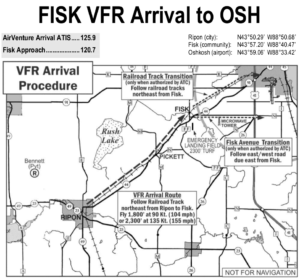
FISK VFR Arrival To OSH
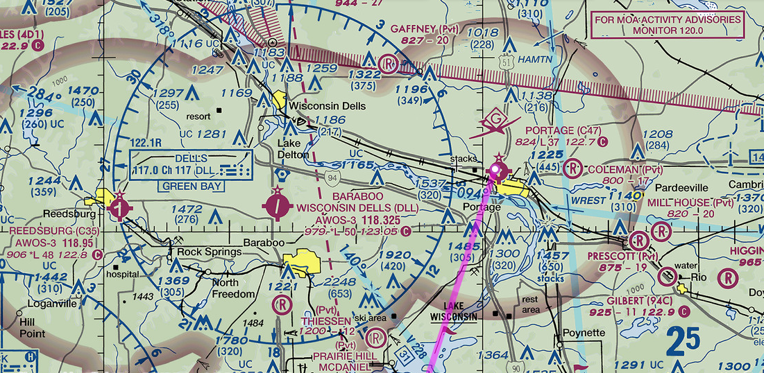
I spent a good hour reviewing the NOTAM the night before and I had a good plan on getting to Airventure. I looked at the sectional several times and tried to get a good idea of the location of the two checkpoints. As both of these points are GPS fixes it did make it pretty easy to find them. The actual locations of the fixes on the ground however are a different story. More on that later. My first flight in was on Thursday and I wanted to get in early in the morning to have the least stressful landing experience. I had experience flying int sun-n-fun in Lakeland FL and I knew that early was better than late. I did a good walk around inspection of the plane as I didn’t want yet another incident. I topped off the fuel, started the plane ran all the pre-flight checks, programmed the GPS with the route and launched off into the air.
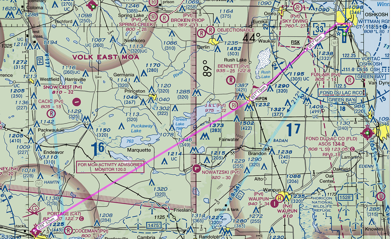
VFR Route Portage to Oshkosh
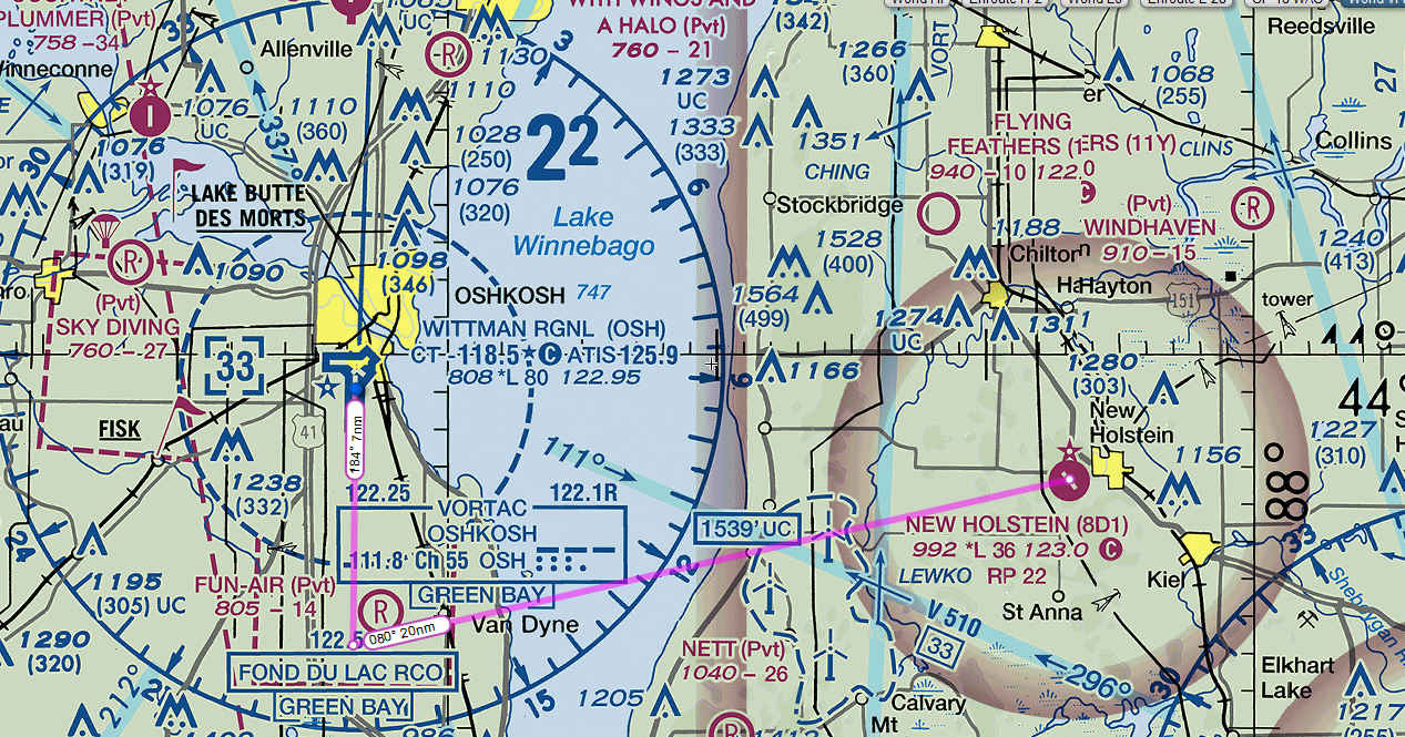
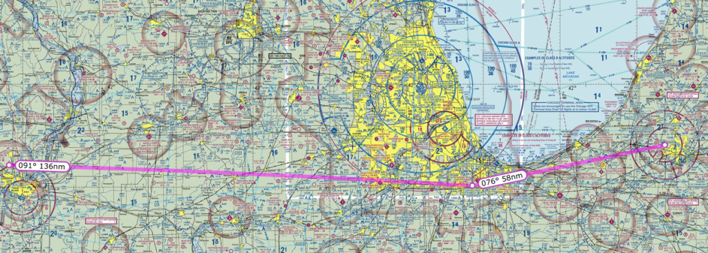
The route from Portage to Airventure was pretty simple. Take off and fly northeast towards RIPON, which also happens to be the name of the town where the fix is located, join the gaggle of aircraft headed to FISKE and plan a landing at OSH. I knew from reading the NOTAM that I needed to be at 1800 feet and 90 knots. Getting to that speed in a Comanche takes a subtle hand. Finding RIPON was really easy as it is a big town and the GPS fix is almost right in the middle so there is little chance of confusing this point. FISKE is a different story. When I reached RIPON I had a bit of trouble finding the railroad tracks. They are not really visible from the air as there are trees grown on both sides of the track that obscure them from sight. Once I figured out that the line of trees was the railroad tracks it made the navigation easier.
Note, that a straight line via GPS from RIPON to FISKE will not take you over the tracks you have to navigate visually as the tracks are slightly south of the direct route between the two fixes. I must admit I never really located FISKE visually on the ground I just watched my GPS and listened carefully for the arrival crew to call out my aircraft. They called me something like a Cherokee low wing so I had to guess that they meant me. I added the ATC audio to the video so that you hear what I heard. I had some fun with the folks at FISKE and I found the chaos at OSH a bit frightening. The tower folks seemed a bit stressed out. This is a long video and it would not hurt my feelings if you skip ahead to the really good bits.
Flight from Portage to Oshkosh
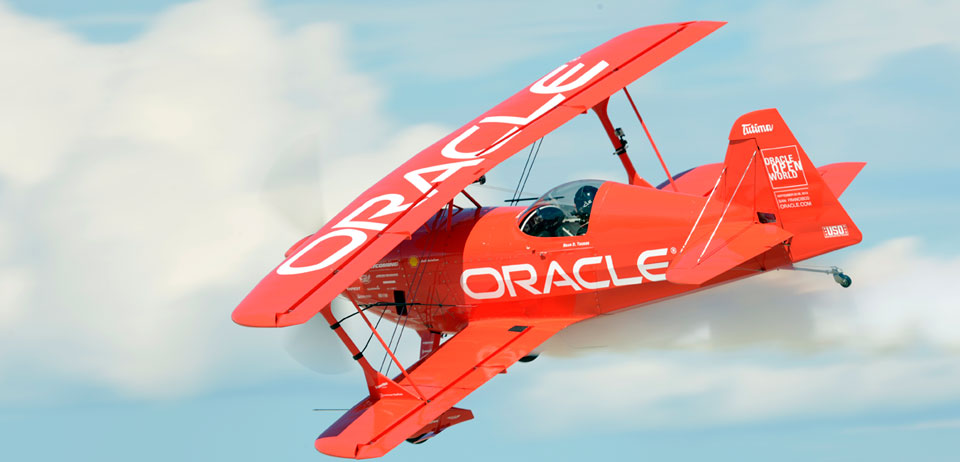
Landing at Oshkosh is really no pressure. Only hundreds of other pilots watching and critiquing your every move as you try to hit the dot on the runway and turn left into the grass before another aircraft climbs up your tail. I did a pretty good job of landing on the orange dot and I think my landing way pretty good. Some young smart-ass pilots were standing beside the flight line with scoreboards letting us know how they thought we did on the landing. I was pleased to see that I got three 8s and one 9s. Due to the age of my Comanche I was entitled to park in the Vintage parking are, which was right next to runway 18/36 and the daily air show. After landing I had to taxi quite a ways but it was very much worth it. I was able to lay under the wing of my plane and watch the air show in shaded comfort.
Oracle Plane Airventure Airshow
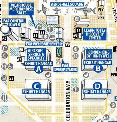
Describing the sights and sounds of Airventure is difficult. Airplanes, people and something to see in every direction. One of my favorite things to do was walk around the vendor hangars. Any company that has anything remotely to do with aircraft was there in these enormous hangars selling their wares.
Exhibit Hangars
There was every kind of product a pilot could ever imagine. Oh sure all the big names were there selling radios and GPS units. What I really enjoyed were some of the quirky vendors selling cooling scarfs, memory foam seat cushions and miniature replicas of every sort of model of aircraft. I did end up buying a few trinkets and a couple of spare parts for my bird but nothing all that spectacular. That magneto repair at St. Louis ate up all my spending money. After a wonderful day, which concluded with a spectacular airshow, I was able to easily depart OSH. I posted a few pics on my Facebook page and a friend who lives in the area saw the post. She invited me to dinner with her family. So I departed OSH, flew south until clear of the airspace , then turned east and headed to New Holstein.
Flying from Oshkosh to New Holstein
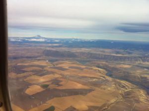
The flight was pretty coming across the lake, over the wind turbines and landing in the grass at the airfield.
Departing from Oshkosh and flying to New Holstein I had a wonderful dinner and gabbed with old friends. What a great evening. Sorry, but I forgot to turn on the camera for the night flight from New Holstein back to portage. I will just say the sky was dark and beautiful all the way back. Best night of sleep I had in a while. Must have been all that fresh Wisconsin air. Stay tuned for part 4!
After spending a few days as tourists in St. Louis, My wife went to her conference and I flew north towards Oshkosh. The flight up there was very easy. I made one stop for refuel on the way up. Link to the Route on Skyvector
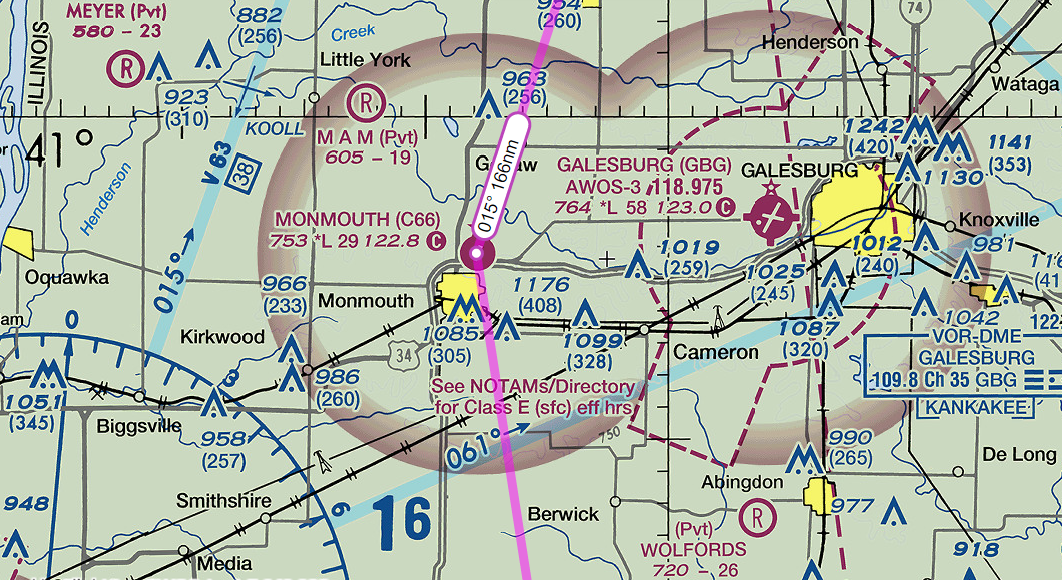
Monmouth Airport C66
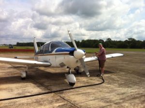
I chose an airport a bit out of the way because airnav.com told me they had the least expensive fuel in the area and as usual they were correct. I saved around 20 cents a gallon stopping here. What a great little airport. They had a homey FBO office on the end of the main hanger and a large agricultural spraying operation going on. I had to negotiate my landing with a
couple of air tractors coming in and out as I was landing. Nice folks at the FBO and they even helped me pump the gas. Video of landing at Monmouth C66
I was experimenting with different positions for the camera on the airplane so you will notice the camera is on the right side and mounted a bit lower. My plan for Airventure was to stay at a hotel located next to a small municipal airport located in Portage Wisconsin. Again I was influenced by the fuel prices on airnav and the ease of access to Oshkosh. I would fly in and out of Oshkosh each day and sleep in a bed at the hotel. I must say it all worked out great.
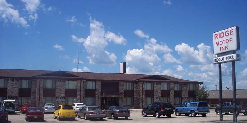
Ridge Motor Inn, Portage
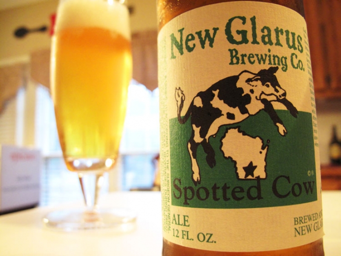
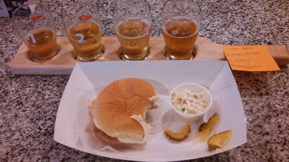
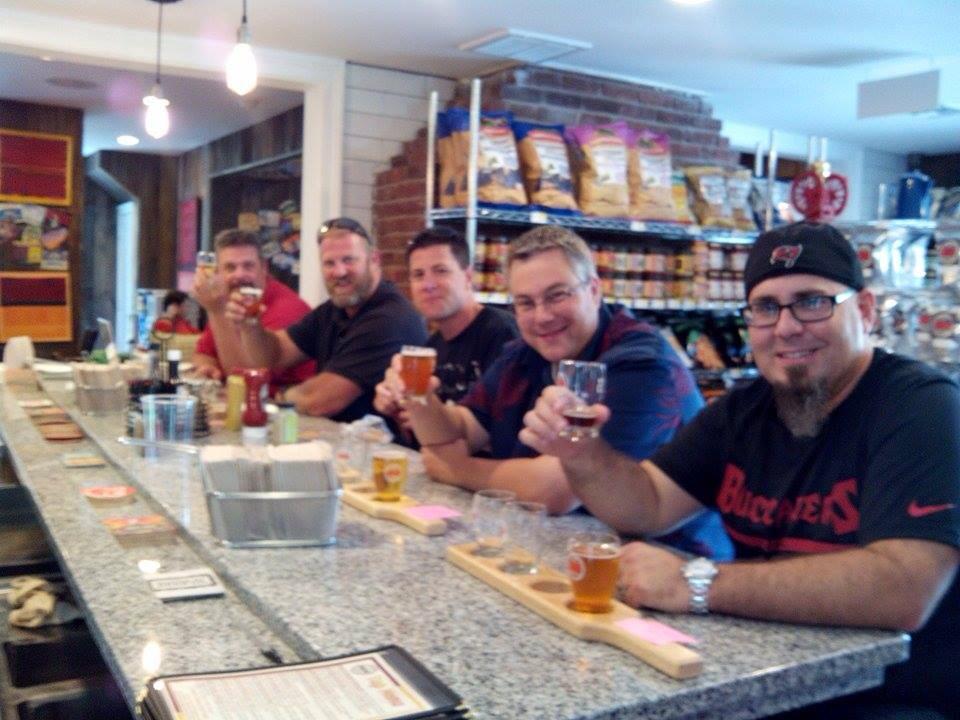
The Ridge hotel, located about 3/4 of a mile and a short walk from the airport, was nothing fancy but it was inexpensive, had a bed, a good working shower and a restaurant that served simple comfort food and ice cold local beers. My favorite beer for this trip was a local brew made by New Glarus Brewing called Spotted Cow and it was really tasty with a cheeseburger with an over easy egg on top.
New Glarus Spotted Cow Beer
Video of Landing at Portage C47
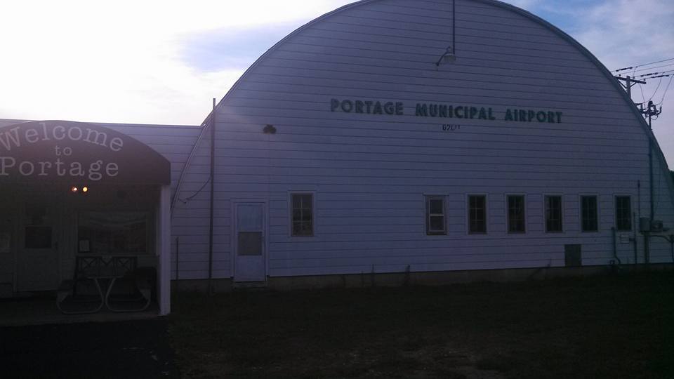
Portage Municipal Airport
The Portage municipal airport was a great spot. The manager was a character! He cussed like a sailor, yet went out of his way to be hospitable to all guests. The airport is located about 48 nautical miles southwest of Oshkosh, the flight would take me less that 20 minutes and provided me with access to low price fuel. I really enjoyed gabbing with all the pilots coming from and going to Oshkosh. I will probably use this same place again as it was a gem.
Portage Municipal Airport FBO
After an uneventful yet enjoyable flight to Portage I put my knapsack over my shoulder and made the short walk over to the hotel for the night. I needed to get plenty of rest and be ready for my first flight into Oshkosh. After a good dinner and a couple of cold beers I kicked my feet up and relaxed and got prepared for the flight to Oshkosh the next day. Stay tuned… part
3 coming soon!
On July 18th I experienced a partial loss of power in my Piper Comanche while approaching the St. Louis Down town Airport. I requested an expedited landing into the airfield as I thought it best to get on the ground.
Video of approach and landing at KCPS
A note about the video. About 1:10 you will see the engine stumble and notice that it seems to sound different and run differently. After the landing you will see the fire truck parade. It seems the approach folks got a little excited and declared an emergency for me. I requested an expedited landing as the engine starting running rough and I lost the ability to generate some power. I did not declare an emergency I only requested an expedited landing as I was unsure if I could do a go around if it was needed. In the end, it was discovered that my right magneto had a broken rotor brush. Seems it was still working sometimes and was throwing the engine timing off. It all ended safely so no worries.
After landing and filling out paperwork with the fire department, we went on our merry way and I thought that was the end of it all. No it was not. A few days later I got a call from a very polite gentleman from the local FSDO. He wanted to let me know that because of the incident, he was tasked with investigating the situation and wanted to meet with me. I agreed to meet and then he asked me to bring my log books. I explained that I was on vacation and did not have that information with me. No worries he said you can send that along later.
Before I got the call from the FAA representative a few fellow pilots urged me to fill out a NASA report. That is essentially a report where a pilot tattles on themselves for what we did wrong, which can help if any legal actions might be taken. I am glad I did so and believe it was a wise precaution. It also helped me to organize my thoughts and present my finding when I met with the FAA representative.
So we met at the FBO and he asked to see the regular documents – my medical certificate and my pilot’s license. I produced them and showed them to him. Then he asked me what happened and I explained pretty much what I wrote just below the video above. I asked him why all the fuss as I never declared an emergency and only asked to be expedited as a precaution.
This was news to him. He was not aware of those circumstances. He seemed to understand though and he wrapped up the questions by asking to see the plane. I took him out to the plane and showed him the standard documents. AROW – Air Worthiness Certificate, Registration, Operators Manual, Weight and Balance.
He looked at the engine, took a picture of the data plate and that was pretty much it. He asked if I would start the plane, which I did and I flipped to the right magneto and it started popping and backfiring and generally running like crap. This seemed to satisfy him that an actual problem existed in the plane.
He asked me about my plan to get it fixed. I told him I was going to take it to the local shop on the field. he asked me to send him a copy of the log entry once it was fixed, plus copies of the most recent annual inspection entry and the AD compliance report. I explained that it would be a few weeks as we were on vacation. He gave me his business card and that was it for that day.
When I returned home I had an email from the FAA Inspector reiterating the request for the documents. I scanned them and emailed them off to him the next day. So now we wait. I have emailed him back and asked that when the report is finalized that he email a copy to me.
Hello All
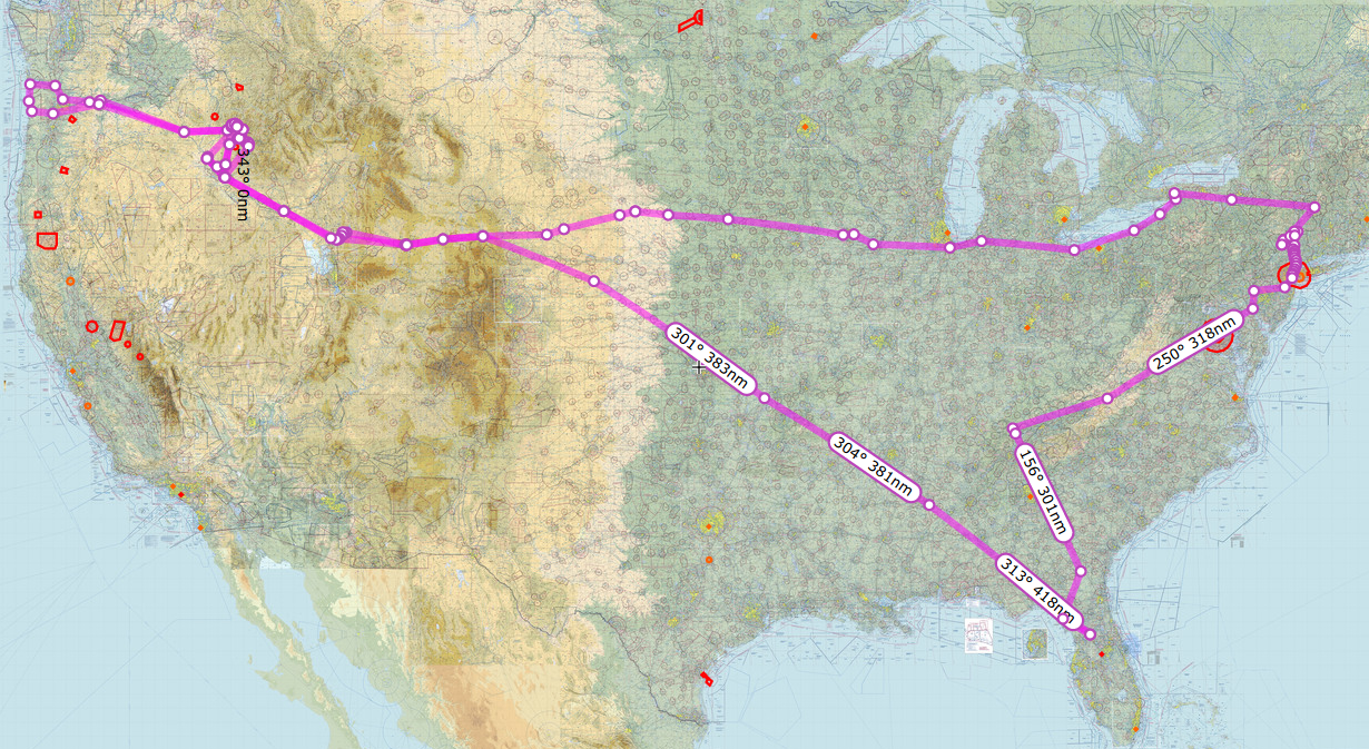
The summer trip has come to an end. We had a good time. It was much shorter than planned but we still did some fun stuff. Our trip this year took us from Ocala to St. Louis then on to Oshkosh, Petit Jean State park, Memphis, Nashville, Crossville, and Spartanburg.
The first leg of the trip took us from Ocala to West Georgia Regional Airport in Carrolton Georgia for a refuel stop. Nice little airport. We borrowed the courtesy car and went into town to grab a quick lunch. The cheap and quick option was a Subway sandwich shop just a few miles down the road. We returned to the airport, lunch in hand and gabbed with some other pilots in the lounge for a bit while we ate and then climbed back in the plane and flew on to our next destination – St. Louis.
West Georgia Regional Airport KCTJ
Video of the Landing in Carrollton
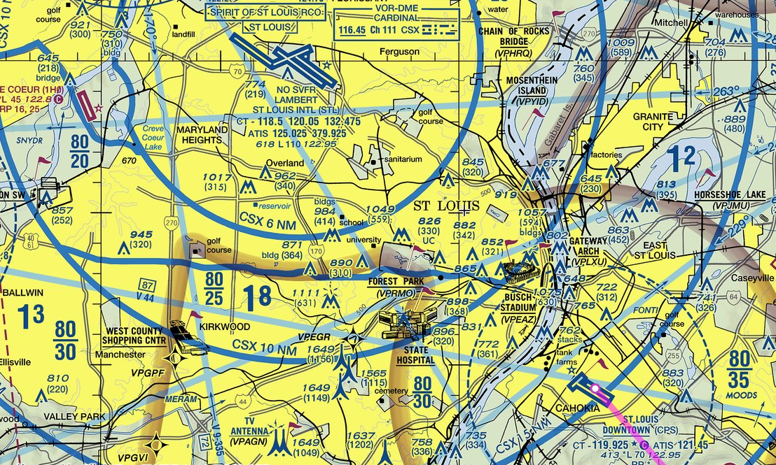
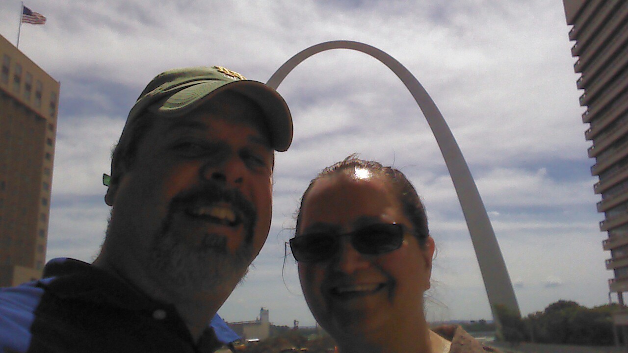
After lunch and a refuel we continued on to our first destination KCPS St. Louis Downtown, which is located in Illinois across the river from St. Louis proper. I must admit it was very cool to look down the runway at the St. Louis Arch just across the river. The flight was pretty easy we had good weather and a light tailwind so we picked up a few extra knots and cruised at about 135 kts at a70% power setting.
Video of the landing at St. Louis Downtown
A note about the video. About 1:10 you will see the engine stumble and notice that it seems to sound different and run differently. After the landing you will see the fire truck parade. It seems the approach folks got a little excited. I requested an expedited landing as the engine starting running rough and I lost the ability to generate some power. I did not declare an emergency I only requested an expedited landing as I was unsure if I could do a go around if it was needed. In the end, it was discovered that my right mag had a broken rotor brush. Seems it was still working sometimes and was throwing the engine timing off. It all ended safely so no worries. The repair was simple and was completed by the shop on the field in a few hours.
We called ahead and the FBO, Ideal Aviation, arranged a rental car and a hotel for us at very good rates. For the next four days we stayed at a Drury inn and Suites to the east of the airport in O’Fallen Illinois, which was a bout a 20 minute drive from downtown. I must say I am a big fan of that hotel chain. In addition to a complimentary hot breakfast they also offered a complimentary simple dinner and free adult beverages every evening. We would get up in the morning and have a lovely breakfast and then spend the day as tourists and return for a hot dinner and a cold beer. From now on I will try to stay at this chain when I travel.
I have to say that visiting the Arch was pretty cool. It was a very easy drive from our hotel. We drove across the Mississippi river and then right into downtown. Finding parking was very efficient and inexpensive. A short walk got us from our parking to the steps of the courthouse, where the above picture was taken. Then a quick walk across the street and into the park under the arch allowed for a close up view of this magnificent structure.
Another interesting stop was the Cahokia mounds. This is the remnant of a native american city that lasted some 300 years. They build pyramids and had a whole city with walls and even their own version of Stonehenge – but with wooden poles. Here is a link to the museum website: http://www.cahokiamounds.org/
So this was our first few days in St. Louis. After this my wife went to her conference, and I continued on to Airventure at oshkosh. Stay tuned for part two.
I’ve made several long distance cross country trips in my private aircraft. I’d like to share some of the lessons I’ve learned. This is by no means an exhaustive explanation of everything you need to know before taking a long trip. Instead these are some key points I try to keep in mind while planning and flying over long distances in my own airplane.
The Long Cross Country
Know Yourself
It is probably most important to understand your own experience and comfort level as a pilot. I remember my instructor talking about setting personal minimums. I wrote my personal minimums on the inside cover of my log book and I still review them each time I write an entry. Before tackling a long trip this would be a good item to review and keep in mind during the planning phase. I know how much crosswind I can handle when landing my plane. If the crosswind is too high I am going to rethink my choices.
One of the biggest killers of small aircraft pilots is a phenomenon called get-there-itis. In get-there-itis, personal or external pressure clouds the vision and impairs judgment by causing a fixation on the original goal or destination combined with a total disregard for alternative course of action. When you are getting ready to make a long trip check your own ideas about flying these long distances. If you start using words such as “I have to be at this place by this time”, it might be a good time to take a step back and reevaluate your priorities for this trip. Often pilots will develop get-there-itis and far exceed there own personal minimums by flying into conditions they would not normally attempt and find themselves in real trouble.
Know Your Aircraft
I most often fly a 1968 Cherokee 180 D. After so many hours of flying I can tell when something is off just by the way the aircraft feels when I start it or when I am flying. I know pretty well how the plane is going to react to particular flight conditions. Knowing these behaviors of the craft you are planning to fly is important. I would not recommend taking a long trip in a plane I’ve never flown. A better plan would be to get to know the plane on a few short trips and get comfortable with the particular quirks of that craft before ever attempting to make a long cross-country trip.
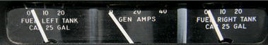
Fuel consumption is critical in a cross country flight and it is important to know how much fuel you can carry and how much your craft will burn in flight. I often plan to have more fuel than just the minimums at each landing site. For example, my aircraft has a range of about 500 miles with day VFR reserves of 30 minutes. Ever consider how little fuel 30 minutes represents? In my plane that is about five gallons of fuel or two and half gallons in each tank. The fuel gauges would barely be off the empty mark. I am not willing to take my plane down to that low of fuel. A strong headwind can increase your fuel consumption considerably and leave your fuel tanks bone dry long before reaching your destination. For these reasons I always plan the legs of my flight to leave me with one hour of fuel upon reaching my destination.
Know Your Route
This may seem a bit fundamental but I try to have a really good idea of where I am going to fly. I take a good amount of time in planning my route, which involves activities such as studying the terrain along my chosen path and making note of any distinctive landmarks or features. I also review approach procedures for my landing sites, and mentally note any alternate or emergency landing sites. I often go on YouTube and look for videos from other pilots that are flying routes and landing at the airports I might use. You would be surprised at how much you can glean from watching a video of someone landing at an airport you might use along your route.
Have a Backup Plan or Two or Three
When flying cross-country I try to keep in mind that the trip is not just about getting there, but also about the journey. Although I plan on going to my primary landing site, I also plan a secondary and even a tertiary landing site. This idea ties into knowing yourself. If you keep an attitude of enjoying the journey and not being rigidly committed to a specific destination you can make better decisions about when to choose an alternate landing site.
Weather conditions can change rapidly and no forecast is perfect. If I see that the conditions ahead in the direction of my primary landing site are not looking safe, I might land sooner or turn on an angle away from my route and away from the weather. When I plan backup sites I often pick one that is before my primary destination and then I also pick one on an angle to secondary. For example if my destination for the day is 400 miles due west I pick an alternate that is 350 miles west and then another that is north or south. This way I have alternates and ways to escape bad weather.
Know the Weather Patterns
When planning a long cross-country trip, I start obsessing about the weather probably two weeks before. Weather patterns are often cyclic and getting to know how the weather will behave during your time in the air is vital to a safe flight. The official sources such as aviationweather.gov , DUATS and 1800wxbrief.com are essential sources. I also like to use Weather Underground’s interactive maps and detailed forecasts to help get a better picture of the weather along my route. I tend to stay away from the full-time newsy cable weather products as they tend to exaggerate and sensationalize the weather and in my humble opinion often give inflated and emotional forecasts.
So there you go some tips on planning and making a safe cross country flight. I hope something I shared here helps you have an enjoyable and safe trip.
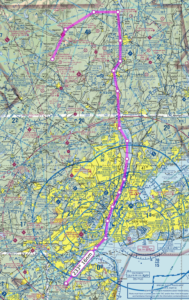
On this day we departed Wurtsboro Sullivan airport and headed south down the Hudson river. I was so excited for this day as I had planned and read up on everything I needed to do to fly the Hudson River VFR corridor.
Flying down the Hudson at 1000 feet from where we started required me to get clearance through two Class D air spaces. The first one was Dutchess County (POU), where I accidentally called them “Poughkeepsie Tower” but at least they knew what I meant. The second one was Stewart (SWF) and they were both very accommodating and understood what I was doing.
There is a lot to see flying down the river. If I were to do this portion of the trip again I would have a tourist map next to me because there were so many things to see. At this point my wife was snapping pictures in all directions all the way to New Jersey.
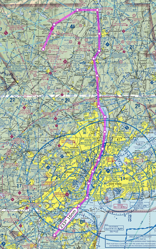
The FAA Safety site published a simple knee-board document that covers the basics of what one needs to know when flying down the Hudson VFR. This doc was very useful and easy to follow. The reporting points are very easy to see and made it no trouble whatsoever to self-announce at the designated points. I kept our airspeed relatively slow at about 90 knots, which made me feel less nervous and gave me time to see and plan for each potential hazard. Flying over the George Washington Bridge at 1000 feet is a bit intimidating, the first time, and I needed to focus to make sure I was clear of all obstacles.
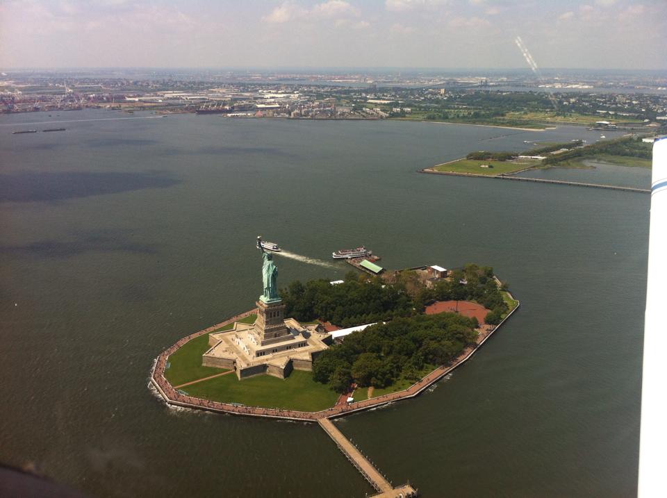
The only time I got more than normal nervous was when we were approaching the Statue of Liberty. As I was passing the Colgate Clock, I could not get a word in on the CTAF as the heliport operators were chatting away about refueling and picking up passengers and who was getting the coffee. I slowed the plane down and finally blurted “Blue and White Cherokee, Colgate Clock, Southbound Jersey Side, 1000 feet, descending to 500 passing just east of the Lady, then ascending to 1000 over the Verrazano”.
Now I had the helicopter pilots attention and they graciously agreed to stay west of the Lady for a minute while I passed. I thanked them for their willingness to cooperate and promised to get out of the way as quick as possible. We then continued over the Verrazano Bridge, followed the South Shore of Staten Island for a while and then headed south toward 3N6 Old Bridge Airport in Old Bridge New Jersey.
This airport is right next to a drag strip and from a distance it is hard to tell which one is the airport and which one is the drag strip as the are aligned almost parallel to each other. To be sure I overflew the field and then entered a right downwind pattern to landed to the south.
Nice folks at this airport. They charged me $5 a night for a tie down space. Fuel was reasonably priced, at least compared to other airports in the area. We stayed here three days visiting with the Wife’s family on Staten island.
My wife’s aunt really wanted to go for a ride in our plane. It seemed like a nice thing to do so I planned out a ride up the Hudson and back down. This time I was feeling much more confident in the trip and knew exactly how to handle the traffic and radio. We took off from Old bridge, turned north and came up the Hudson, flying on the right side (NYC) and got to see all the sights going north. We went all the way up to the Tappan Zee Bridge and then turned around and came back down on the Jersey side.
This time as we approached the Colgate clock I negotiated with the helicopter pilots and they let me get low and slow next to The Lady and I thanked them greatly for all their cooperation. My passengers really enjoyed being able to look Lady Liberty right in the eyes and take a picture of her. My wife’s aunt was quite funny. She asked me to go under the Verrazano. I did think about it for a moment but decided it was best to go over and not under.
We spent the next few days there on Staten Island visiting with family, cooking, eating and enjoying the summer weather. We had to delay our departure one day and perhaps it should have been two days.
Day 26 August 3rd
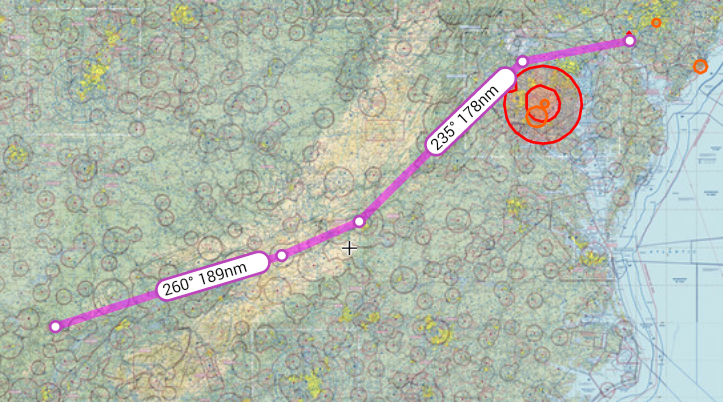
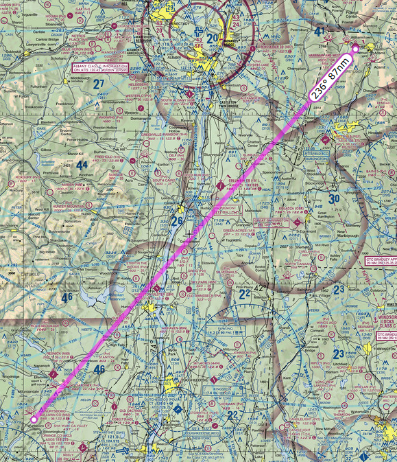
Today we departed Old Bridge New Jersey. The plan was to fly west on the north side of the Philadelphia airspace to the Pottstown VOR (PTW) then turn southwestward to the Westminster VOR (EMI) and then land at KGAI Montgomery County Airpark in Gaithersburg, Maryland to visit an old friend. I spent quite a bit of time over the previous days making sure I knew exactly what I needed to do to fly into the restricted airspace around DC. Essentially it came down to at a minimum being on flight following and making sure they knew we were headed towards DC.
The weather that day was reporting as marginal VFR for the entire route. Broken ceilings were forecast for an average of 1500 feet the whole way. The cloud layer itself was only predicted to be about 100 feet thick. Once airborne from Old Bridge airport, I contacted ATC and got on flight following and made my intentions to enter the restricted space clear. They understood and issued me a squawk code and asked me specifics of my route. I explained that we would head west to the Pottstown VOR PTW then southwest to the Westminster VOR EMI then south to KGAI. We were all set with ATC and continued our flight.
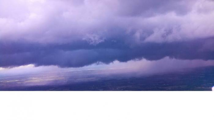
The ride underneath the clouds was pretty rough so I decided to climb above it at the first opening, which we did. This was going great and were were essentially VFR on top of mostly solid cloud layer at about 2000 feet. All was going great until we got a bit east of Philadelphia, just past the Pottstown VOR. A second layer of clouds formed above me at about 3000 feet so I was now between layers. This was not a problem as I could clearly see sky between them all along our route. At least until all of sudden they closed up and I was in the midst of a moderate rain storm in Instrument Meteorological Conditions (IMC).
I must admit I was caught off guard. The radar showed nothing and there were no rain storms predicted for that day. Also the weather conditions did not show a rain storm, at least not in the way I am used to seeing them. The weather that day was strange indeed.
I was not really worried about it as I have an instrument rating, but I am way out of currency. The storm however made things a bit hairy. So I radioed approach and let them know what happened. I instantly had the controller’s attention and he started helping me get back out. Turning back was not really an option as the clouds closed in around us and turning back would keep us in the same situation. I knew that the cloud layer ended at about 1200 feet so I reduced power, kept the wings level and began a slow descent out of the clouds. In the mean time ATC informed me that no airports along my route were VFR at this point.
Great! Now we are stuck. I asked for vectors to the nearest VFR airport. The nearest one was KILG New Castle Airport in Wilmington, Delaware. The rain was pretty heavy at this point and we were getting pushed around some by the wind. I informed ATC about the storm and they had no idea there was rain happening at that location. I was instructed to continue my descent until clear of the clouds and report field in sight. I did as instructed and then landed on runway 14 at KILG.
As we were taxing in ground control informed me that Philadelphia ATC asked for a contact number. I supplied one and expected I was probably going to get an arse chewing for flying into IMC conditions. We parked at the FBO and topped off our fuel. I again checked all the weather conditions, and outside of this storm, everything along my route from this point showed MVFR. I was perplexed.
We made an attempt to get out of KILG and finish our flight to KGAI but it was no good. Low lying clouds all about and there was no safe route out. So, we landed again and spent the night at a nice hotel. The Atlantic Aviation FBO folks were so kind. After arranging a special rate for us at a hotel, they even gave us a ride over and said they would come pick us up in the morning if we called. I give them five stars for customer service. We got a good dinner in town, a hot shower and a good night of sleep.
Day 27 August 4th
The weather this day was much better. We departed KILG and headed for our fuel stop of KMKJ Mountain Empire in Virginia. I got on flight following as soon as I could with Pittsburgh and I am glad I did. When I was doing my morning flight brief I saw the usual TFR’s in effect around DC, but ATC would not let me go directly through, so I had to route around DC. One interesting point. After my request for flight following the Philly ATC repeated twice to me “Maintain VFR at all times” I had the thought that they might have flagged my tail number, since my incident with the storm the day before.
The Route on SkyVector
I want to give some kudos to a great little airport in VA called Mountain Empire. KMKJ. These folks are super nice. Stopped for refuel once before and the service was excellent. Full service fueling at a lot less than any other airport in a 50 mile radius. If you have reason to stop it is a great place. We borrowed the courtesy car and drove a mile south to a local eatery called the Red Barn Restaurant and had a nice home-cooked meal. If you ever get the chance to stop in, try the stuffed peppers.
After refuel we took off again and continued on our way to Crossville, TN. I picked up flight following and again ATC again made me read back to them “Maintain VFR at all times”. Okay I was getting a bit paranoid.
KCSV Crossville Memorial-Whitson Field Airport in Crossville, Tennessee was a great little airport for our stop. Fuel was reasonably priced, parking was free and the airport was well kept. On the flight into the airport I requested the runway 26 ILS approach, just for practice as the weather was clear, only to find out that the glideslope was out of service. Oh well. Lastly the terrain around the airport was spectacular to view. To the south was a ridge line, to the north was some beautiful rolling hills and east to west was a river valley full of green fields. What a great view.
We spent the next week there in Crossville visiting my father-in-law at his summer condo. We had a great time sight-seeing and trying some local cuisine. What a wonderful place with lots of beautiful scenery.
Day 38 August 13th
On this day we departed Crossville for our final journey home. The weather was partly cloudy in Crossville but the clouds were plenty high enough that I could see the mountain ridges well below them. We took off and started flying south. I attempted to get on flight following immediately with Atlanta Approach but the radio reception was very weak until we flew just south of the first mountain range by the Hinch Mountain VOR. Once over the mountain range, I was able to pick up with ATC and get on flight following. The planned route was direct from Crossville all the way to Leeward Air Ranch as we left our car there with some friends.
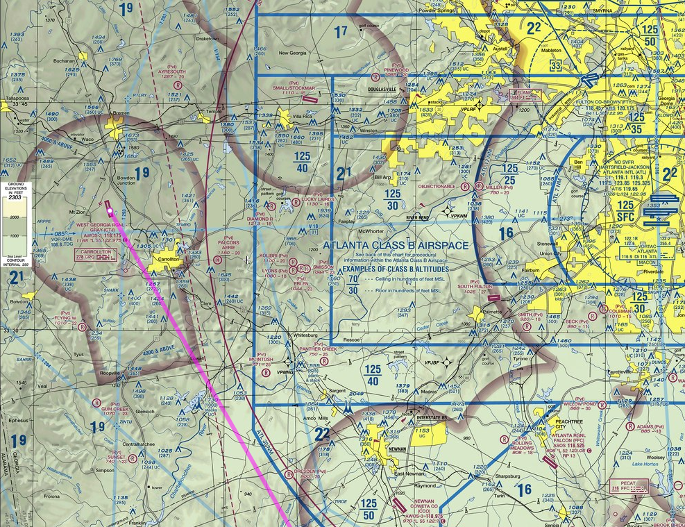
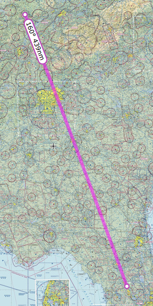
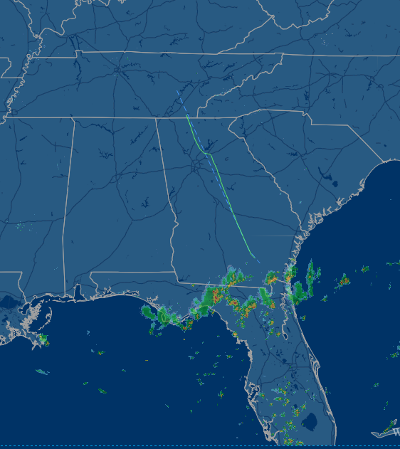
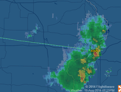
The route took us through the Atlanta airspace. I asked for clearance through the class bravo and was granted. ATC gave me a fix point to fly to and then continue south. I asked for it twice and looked it up but could not find it. The point kept coming up somewhere down in South America. So I told ATC I would just fly around, instead of through their airspace. As we got closer to the southern border of Georgia, I could see the storm clouds ahead. I looked at the NEXRAD radar on my Garmin 396 GPS and sure enough there was a line of large thunderstorms right across northern Florida. At this point I made the decision to make a rest stop and check out the weather situation. I contacted Atlanta and let them know we would be diverting to KAYS Waycross-Ware County Airport in Waycross, Georgia
The Waycross airport is a really great facility. They have a nice pilot lounge with comfy chairs and a good planning room with modern computers. We waited out the storms for a few hours to see if they would move off to the east enough for us to get around them. Since it was near dinner time we borrowed a courtesy car and went into town and got a nice meal.
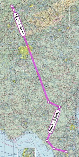
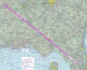
After we returned to the airport, I checked the weather again and the storms seemed to be dissipating some and no new ones were building behind them. We took off from Waycross and picked up flight following. The ATC at Jacksonville advised us that the best route around the storms was to turn east and fly to Cross City Airport KCTY, near the west coast of Florida and then fly somewhat southward until clear.
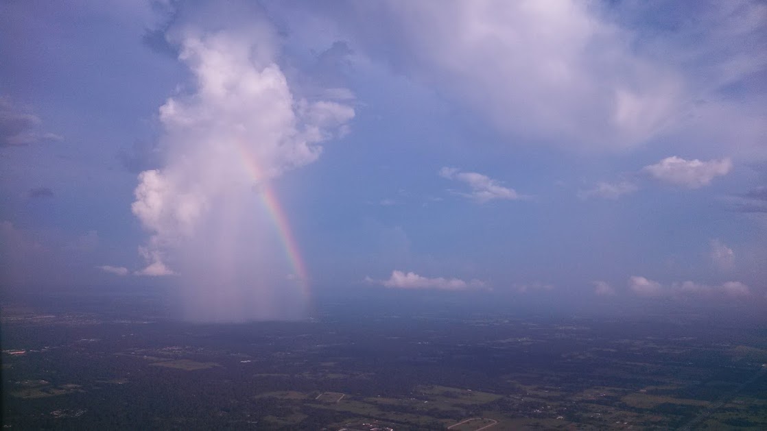
This seemed like a reasonable plan and so we headed out southeastward towards Cross City, which took us just outside the storm. In a strange way it felt good to see familiar cloud formations that were easier to interpret. I could tell exactly where the storm ended and where it was safe to fly. We proceeded south from Cross City past the storms until we were clear and then turned towards Leeward Air Ranch. As if not to be outdone, a single storm cloud was just east of Leeward and was dumping rain just west of the runway. This cloud was somewhat unique as it was dumping rain out if it’s side instead of the bottom. Fortunately it was far enough out of our way to make an easy landing at our destination.
Piper Cherokee Landing 18 at Leeward
The numbers (Best Estimates)
Miles traveled: 6600
Hours of flying: 68
Gallons of Fuel: 680
Day 15 July 23rd
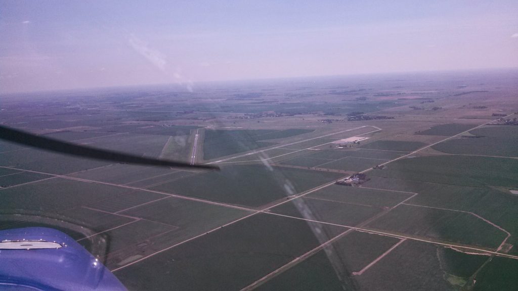
We were so close to the holy land, Notre Dame University, that we considered it our duty to make the pilgrimage. This day we flew from KDVN Iowa to KSBN South Bend Indiana. This was a very easy trip. I flew slightly southeastward to stay out of O’Hare’s airspace and just south of Lake Michigan.
I didn’t use flight following this time, as it was a short hop. We did see several other small aircraft in the area and I swapped between CTAFs for several of the local airports and was able to self-announce and navigate the slew of municipal airports without causing any problems for the local traffic.
The landing at South Bend was pretty much uneventful. I did however initially line up on 9 right instead of 9 left as instructed. I caught my mistake when I was still far enough out that it did not cause any issues for all the passenger jets landing there. I did confirm with approach at South bend that they wanted me to land on 9 left and then did confirm that I should land on the runway with the big “9L” painted on it. I guess it was a slow day and they were feeling snarky.
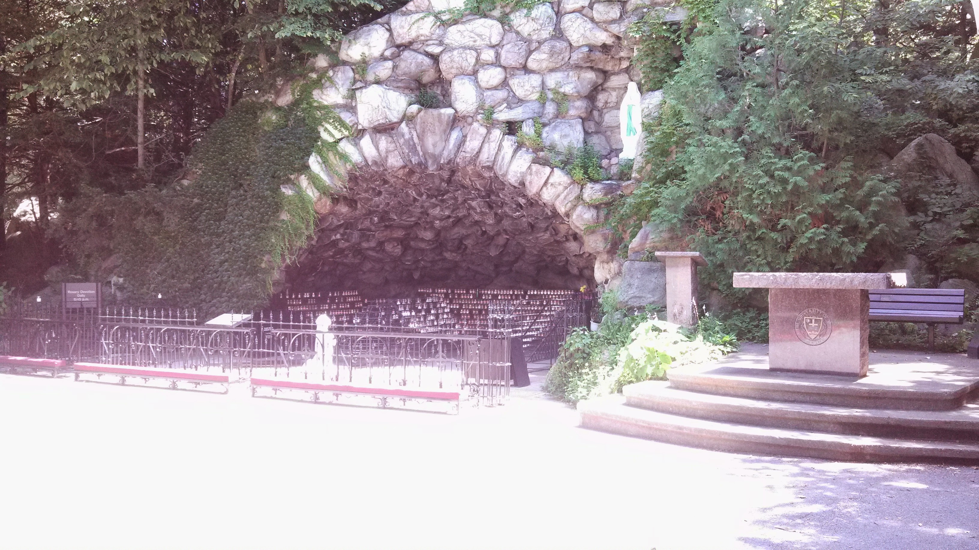
The local FBO, Atlantic Aviation loaned us a crew car for a few hours and we went on campus, visited the grotto and the bookstore as I needed a new hat. A quick shout out to the really great people at this FBO they treated us as nice as the folks coming in on the Lear jets. I had them top us off with fuel and this waived any landing and parking fees.
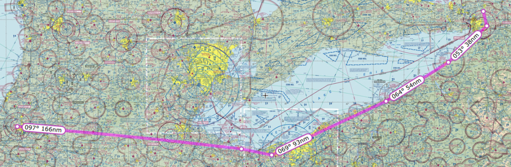
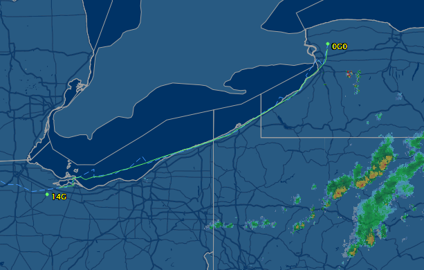
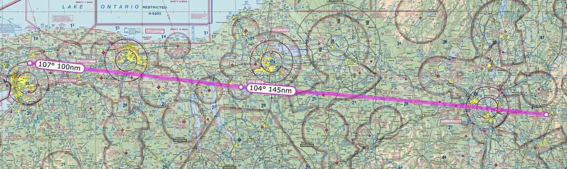
After visiting the grotto, lighting a candle for all my aviation family, and buying a hat, we headed back to the FBO and traded the crew car for my plane. The ground control folks wanted to know our destination and we ended up chatting it up about us flying to Niagara Falls. The departure folks even wished us a safe journey to the falls, some really nice people in that tower. Our planned route took us northeast along the coast of Lake Erie and then finally north to the town of Lockport New York.
The flight along the lake was easy going and we stayed on with flight following all the way. We did run into a few clouds on the way up and I had to climb up to get over the layer. Once we reached the northeastern edge of lake Erie, the clouds stopped and we made a leisurely decent into the town of Lockport. A few words about this airport, the runway was in rough shape as you will see in the video. The western edge of the runway was full of potholes and were marked with orange cones so I had to land to the right side of the runway. You will hear my wife’s comment in the video that it was a bumpy runway.
All during this trip I looked for small airports and local attractions that we could patronize. Lockport was a gem of a place to stay. We found a locally owned and operated motel, Lockport Inn and Suites, right out of the 50’s that was super nice and there was a fantastic Greek diner, Kalamata Family Restaurant, which served really good food. In fact I tasted some of the best haddock I’ve had in a long time.
Day 16 July 24th
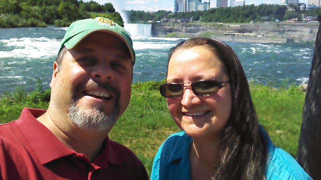
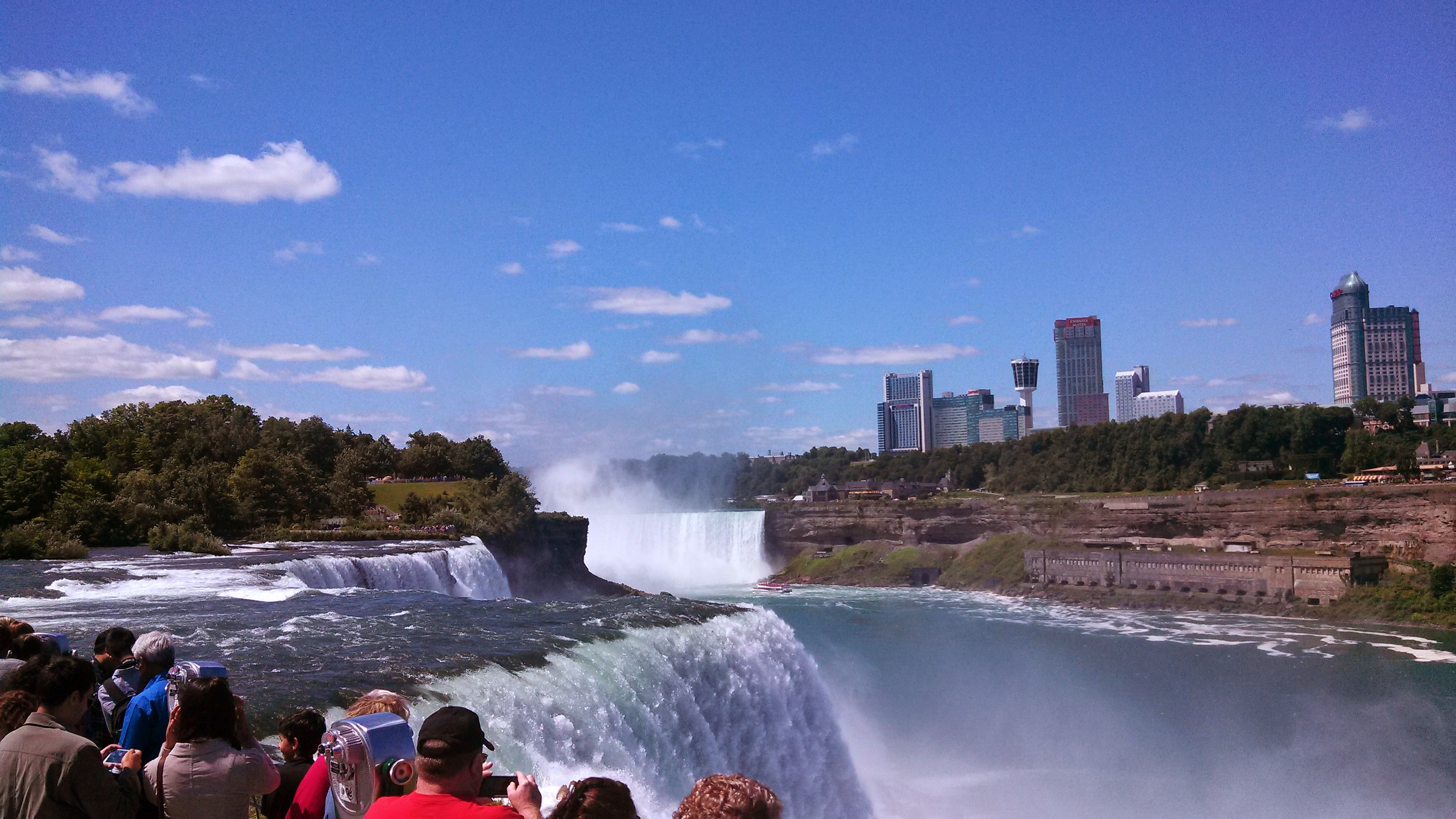
We arrived late in the day and got a great night of sleep in our motel. The next morning, we rented a car and spent the day exploring Niagara falls. We walked around and looked at all the falls and generally had a good time as it was my first trip there.
To top off our evening we went to the local drive-in theater, Transit Drive-In Theater, and ended up seeing the Disney movie Planes 2 which was really fun. Lockport boasts one of the few triple feature drive-ins that shows three different movies on three different screens at the same time.
Today we departed Lockport in the mid-morning for KAQW Harriman and West Airport in North Adams, Massachusetts, where lives my mom.
The trip was pretty short and easy. There was no fuel at Lockport, at least I could not find anybody around to unlock the pumps, so I flew to another airport not too far away. About half way to our destination, just west of a beautiful lake was a little private strip, that is open to the public, called Skaneateles Aero Drome in Skaneateles, New York. Pronounced scan-eet-alice. Nice place and inexpensive fuel!
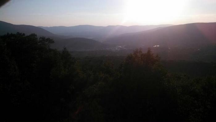
After the refuel we flew pretty much directly to North Adams, which took us right over Albany’s Class C airspace. There was a considerable haze on the mountain ridges as we approached our destination, so I had to stay at a bit higher altitude than I planned until I was sure I had cleared the ridge line obstacles. Once I was sure we were clear of the wind turbines along the ridge, I descended into the valley and landed.
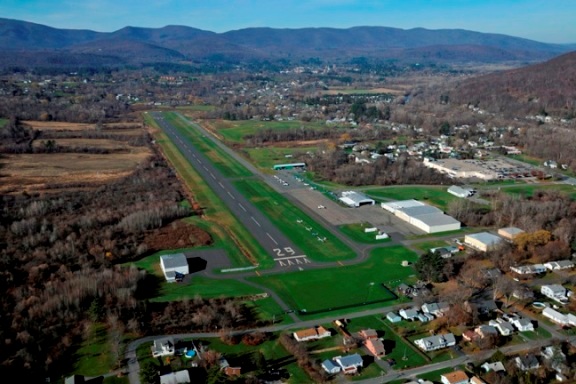
Landing at Harriman and West is a bit intimidating to the uninitiated, especially when landing on runway 29. The downwind leg takes you just over the reservoir which is a lake that sits on a hill at about 1200 feet. Just after coming abeam the numbers and reducing power you are suddenly looking at a lake just a few hundred feet below you on the side of a mountain. If one is not prepared for this spectacle, they often stay too high for the base leg or extend the downwind much longer and turn late.
A quick note about this airport. It is run entirely by volunteers. The city does not have the funds to maintain it so the local pilots keep it up all on their own. I think that is great and they seem to be doing a fine job.
We stayed here three days with my mom and enjoyed some home cooked meals. We visited a few of the local attractions and even drove up Route 2 to the top of the mountain so we could take a picture of the valley.
Day 20 July 30th
This day we left North Adams KAQW and flew a southerly route to Wurtsboro Sullivan N82.
We were there for the next four days for the wife’s 20th reunion of Up With People. The trip there was a bit nerve racking. We were in the lull between fronts as the low pressure system was spinning over upstate NY. I had to time it well to get out of North Adams and get to Wurtsboro before the next wave of storms. Fortunately my calculations of storm movement and direction were accurate and we made an uneventful, if a bit bumpy trip there.
Sullivan county is just a few miles off the Hudson river in upstate New York. The premise of the movie Dirty Dancing is based on this area. There are several vacation lodges with cabins and rooms all over the area and we saw many city dwellers dipping their feet in the ponds around the county. We stayed at a really wonderful place with a great bonus. Across the street from the hotel was a coffee shop, with homemade bagels and a microbrewery. It was like a one stop shop for all my vices.
While I was there, I ended up taking a short flight around the area with a couple of the other husbands who got dragged to the event. We got fuel at Kingston Ulster 20N and got chatting with the attendant and he let us in on a little secret. There is a fantastic restaurant at Sky Acres airport 44N. So we flew down to sky acres, which happens to be an uphill runway on the side of a hill. It was kind of fun landing there. We got all excited to eat only to find out it was closed during the week and only open on the weekends. Oh well. We did also find out that the company Sky Geek – www.skygeek.com is also based at this airport. All in all it was still a fun day for us and after parking the plane we went and drank beer with other husbands. I put this day in the WIN column!
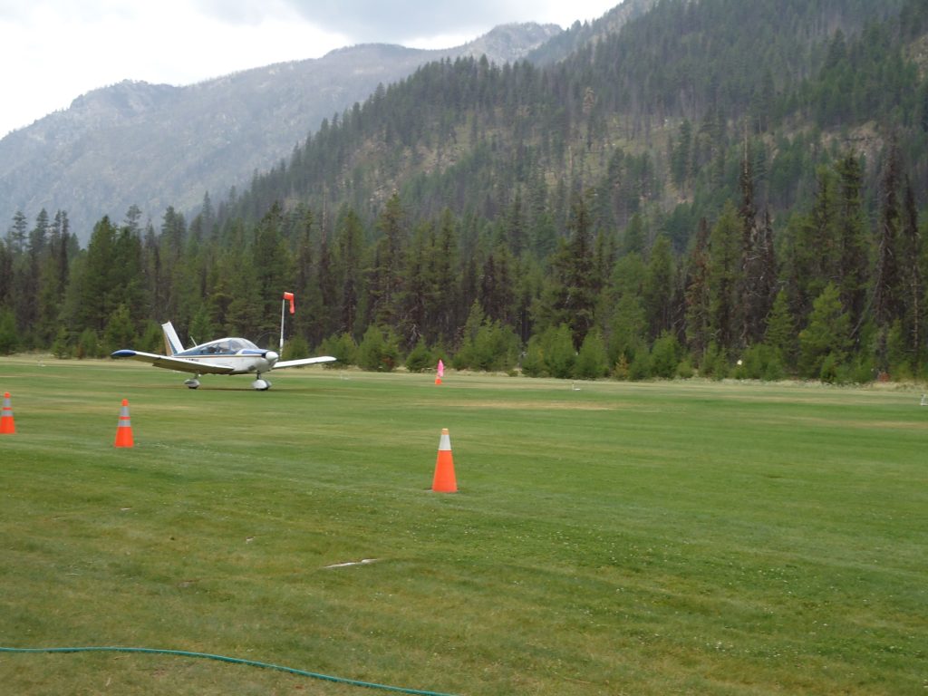
We flew back from KBOI to Johnson Creek in the evening. It is OK to fly in the morning up until about 1 pm and then again after about 6 pm. I was not aware that just about this time in the evening the winds start shifting from the south to the north. In fact, the wind often gusts during this time.
I got my first taste of a downdraft & tailwind mixed together. While flying the downwind leg for 17 I observed that the windsock was hanging still. So I continued and planned to land runway 17. As we turned final for 17 and descended I had power all the way out to help with descent as I was again a bit high. All of a sudden we got pushed hard from behind and the nose dropped and the plane accelerated. I went max power and started climbing out for a go around. As luck would have it, just about that time the constable from Yellow Pine, the village north of the field, was passing by the field and I guess I flew over his vehicle close enough to make him take notice. He stopped by the airfield to make sure everything was OK. I ended up landing 35 this time as the wind was strongly out of the north.
Day 11 July 20th
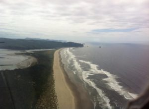
Today we flew from Johnson Creek to Tillamook Oregon via the Columbia River. This route is often called “The Gorge” We departed Johnson Creek early in the morning and used the northern pass out of the mountains and flew over to McCall to refuel. We then headed out to the west going to the Baker City VOR BKE and the northwest to the Klickitat VOR. From this point on I was following the Columbia River. There was a cloud cover at about 1500 feet which required me to drop down below what flight following could track me so we dropped off flight following and went VFR.
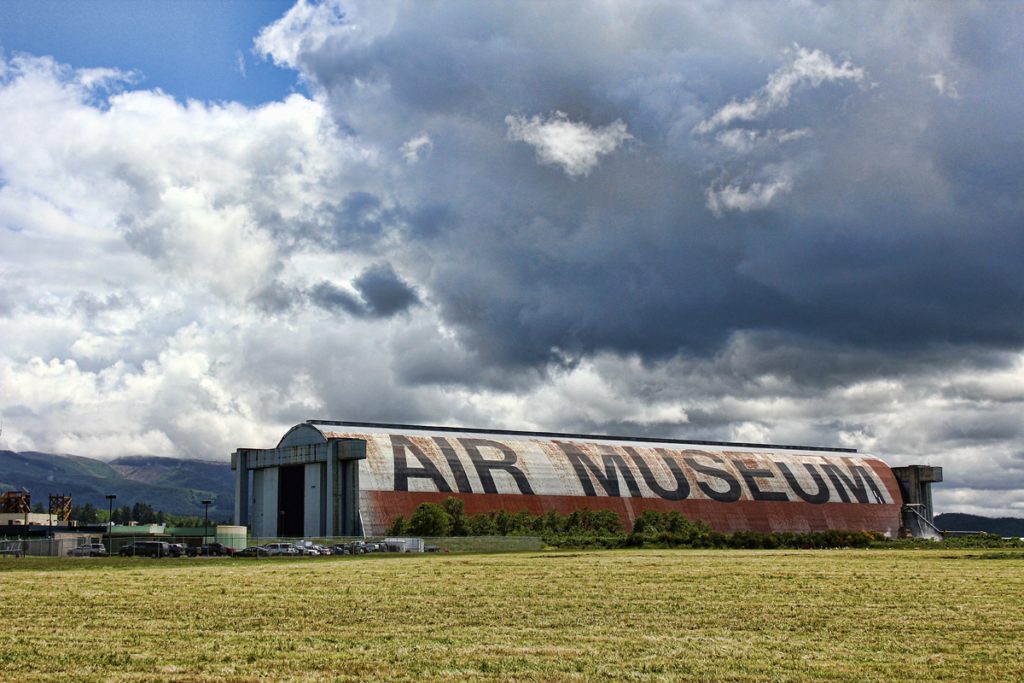
We needed fuel and the recommended stop was 4S2 – Ken Jernstedt Airfield Airport in Hood River, Oregon, referred to as “Hood River” by the locals. This was a very challenging landing as the wind was gusting at 20 knots down the runway. I also found out that there is a huge museum right behind this airfield called Western Antique Aeroplane and Automobile Museum that we missed.
After we took off and proceeded west, I contacted Portland Approach and we stayed on with them as far as we could. They were really nice and let me cut through the Class C airspace a little north of the airfield and river.
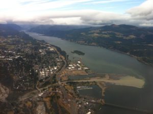
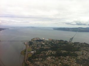
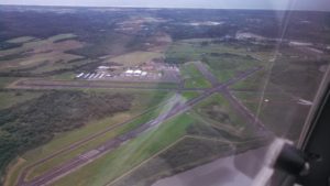
The cloud layer was pretty low at this point and we flew along under it at about 1000 feet using the Columbia River as our guide. Then we emerged out from under the clouds and we were almost to the coast. We flew over Astoria Regional Airport, and then turned south down the coast to Tillamook.
Sadly the museum did not live up to the hype. The museum owner had some dispute with the aircraft collection owner and he pulled all his airplanes out of the museum. That was really disappointing. There were still some really cool planes, but I did not get to see all the one I hoped to see.
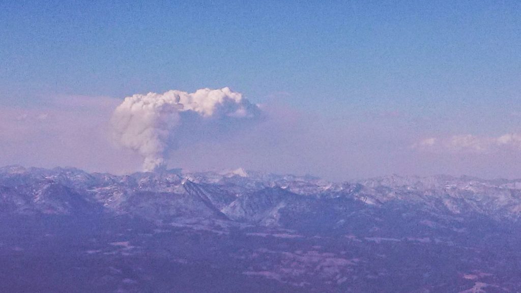
Flying back was pretty much uneventful. Once clear of the low clouds, we bobbed along at about 9500 most of the way. We did get to see something very unique. There was a forest fire burning north of our route and it looked like a volcano erupting from the middle of the woods.
On this trip we flew to the north side of Johnson Creek and came into the airport through the northern pass, which starts just east of the McCall airport. There is a road which follows the river all the way from the town of McCall into Yellow Pine. I wish I had video as the experience of flying through this route was spectacular, however my camera operator and wife did not enjoy the experience as much as me. We were flying at about 6500 feet with peaks all around us and narrow deep valleys This made her a bit nervous. This landing at Johnson Creek was uneventful. This was out last night at Johnson creek and we planned to depart and start heading east.
Day 12 July 20th
This morning we departed from Johnson creek and flew to Rock springs. It was sad to go as we had such a great time there. The care takers Phil and Roxie are some of the best folks I have ever met. They really do a great job keeping that place clean and running smoothly.
I want to mention my death defying takeoff, not to brag but as a learning point. We were 200 lbs under gross weight and the time was 7:30 am and density altitude was 5900. I had to do a combo soft field into a max performance takeoff just to clear the trees. I will admit it frightened me when I had to yank the plane into the air and then ride just above stall at about 50 fpm. Then slowly and I mean ever so slowly creep over to the canyon wall and use the updraft to gain altitude.
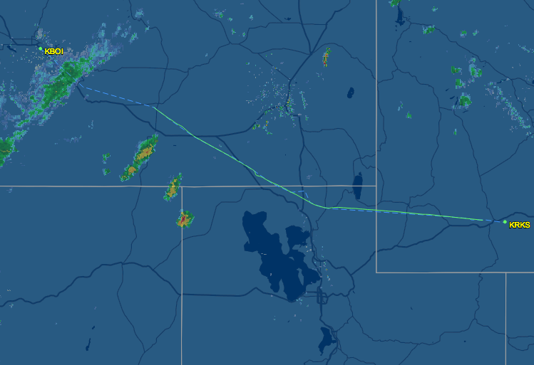
Once we got going and I calmed down from the takeoff, the rest of the flight was good. We flew south out of the mountains and made one last stop at Payette S75 for a full tank of that inexpensive mogas. We picked up flight following as we traveled southwest towards Biose and I am glad we did. They were able to help us get around some rain storms on our intended path.
Once we got past the rain in Boise the skies were clear and the tail wind was something! I tried to keep an average altitude of 10,500 but that was difficult due to the lumpy air. Air speed indicator showed about 90 knots. The GPS showed a ground speed of about 120 knots! Must admit it was a bit rough going and my arms were tired from fighting the turbulence. We did however, get a nice look at Salt Lake Utah in the distance as we headed back to Rock Springs.
This time our landing at Rock Springs was on that huge runway 27. I had to keep telling myself that I was at the proper pattern altitude because the runway was so big and it looked too close.
Day 13 July 21st
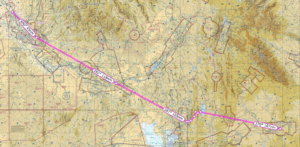
We spent the night in Rock Springs at the Holiday Inn Express and then flew out early in the morning. I knew that the takeoff would be a very slow climb so I was prepared for it. I did not use flaps and just let the plane roll down runway 27, it is plenty long, until it was ready to fly and then slowly climbed up. Going east was much easier as there is no steep mountain to clear and a nice open valley to follow along through the mountains. I essentially followed highway 30 all the way out of the rocky mountains.
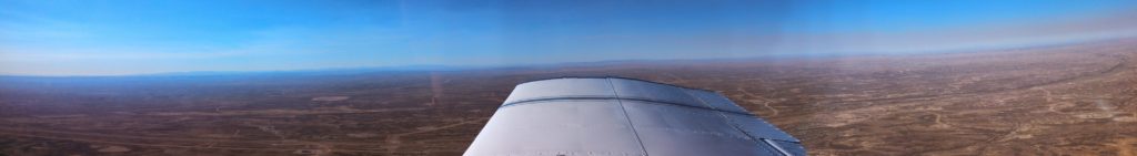
Once we exited the rockies, I flew almost due east then turned slightly northeastward to our refuel stop of KANW Ainsworth Regional Airport in Ainsworth, Nebraska. One interesting fact about this little airport is that the FAA has a big office here and I believe several flight service folks work at that office. However I did not see them as they were behind locked doors. The FBO did have a really nice pilot lounge and some really comfy couches, which made for a nice snack break.
Ainsworth Regional Airport was just about on the edge of the terrain change. Once east of this airport everything started getting greener, and a whole lot closer to sea level. I was able to fly at lower altitudes and get bounced about much less.
From Ainsworth Regional Airport we continued east at a considerable speed, we got a 30 knot tail wind for an average of 140 kts ground speed, to our evening stop of Davenport Municipal Airport in Davenport, Iowa. We did encounter a few light rain storms that forced some course deviations on the way to our next stop. As always I was on flight following and they were a big help. They even asked me for a few PIREPS as we passed close to a few of the storms. I thought it was cool that many other pilots got to benefit from my sharing about the storms, their intensity, tops and bottoms and the air conditions around them.
The landing at Davenport was a bit of a challenge. There were storms in the areas and the wind was a right quartering cross-wind gusting at about 17 knots. I really had to work hard to get the plane down safely on the runway.
I had my right foot all the way down on the right rudder and it was still not quite enough to keep us straight. I added 8 knots, half the speed of the crosswind, to my airspeed so I was landing at about 78-80 knots. With that extra speed I had to work a bit harder to get the plane down to the runway. In the video you will notice my hand on the dashboard. That was to help keep me steady as I fought the crosswind. After landing you will notice that we get pushed to the left and I have to steer the plane back to the center.
The folks at Davenport were super nice. Since I bought gas and planned to spend the night, they loaned us a crew car to take to our hotel. This car was a couple of notches above the average courtesy car we normally use. This was a super nice, late model American sedan with plush leather seats and super good A/C. Another amazing bonus was a Cracker Barrel restaurant right across the parking lot from our hotel. As luck would have it we had a gift card for Cracker Barrel and feasted like kings!
Much planning and discussion of the route for this trip took place for weeks before the actual event. I discussed the route with several other pilots and finally came up with what was considered a safe and survivable route.
The numbers (Best Estimates)
Miles traveled: 6600
Hours of flying: 68
Gallons of Fuel: 680
My original flight training took place in the western mountains of Massachusetts, so I had some relevant experience with flying around and understanding the weather phenomena that occur in mountainous terrain. I did however recognize, that the mountains were much higher and the risk was greater in the Idaho back country. I devoted quite a bit of time to reviewing everything I could find about flying into the Idaho back country and more specifically, Johnson Creek airport. I read pamphlets, web articles and watched many videos on the subject. I also started obsessing about the weather about two weeks before we departed so I knew the weather patterns well.
One video that was particularly well done and very informative is this one by Greg Swingle:
I feel these factors, good route planning, studying up on back country flying, and knowing the weather patterns were essential to the success of the trip. Having a backup plan was also very useful. I had a plan A, B, C and sometimes D for each leg of the trip.
Day 1 July 10th
We loaded the plane to within 60 lbs of gross and headed off northwestward. The basic plan for getting to Johnson Creek was to fly four hours, refuel and then four more hours before stopping for the night. Out first planned stop was M83 McCharren field for a quick refuel and stretch break. I picked up flight following just after lift off. For the next four hours they were a constant companion in my headset.
The flight went well until we got close to our destination. I was turning east, then west, ascending and descending to avoid the rain clouds that popped up. About fifty miles from our planned stop at McCharren, I realized we were getting low on fuel. When I state that we were low, we were down to the FAA safe minimum of 30 minutes remaining fuel. I changed plans and went to the closer planned alternate of KUBS Columbus-Lowndes County Airport in Mississippi.
KUBS was a nice stop. The FBO was in the midst of a face lift and a crew was working on the interior. The bathrooms were clean and in good shape and they did have a nice little pilot lounge in the making. After refuel we took off and had to deal with the Class C airspace right next door. What a pain! instead of letting me turn west then north I had to turn south then east then north and go all the way around. Quite frustrating but I understood afterward that had I gone east then north I would have ended up right in the middle of the approach path for incoming flights. We finally got back on track with flight following and continued to KMIO Miami Municipal Airport located in Miami Oklahoma. Quick note Miami is pronounced “my-am-a” at this particular location as it is a Native American word.
Had a few moments of excitement on the way in to KMIO. Encountered some moderate rain and approach guided me around the worst of it. Went through about 4 miles of downpour that brought visibility way down.
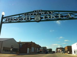
Oh! The best part. The runway at KMIO is closed for repairs. I saw the NOTAM during my morning flight brief on DUATS and called the airport to confirm. The airport manager let me know there was no issue and he instructed me to land on the taxiway. No problem!
What a wonderful place. There is one of the longest restored sections of Route 66 running right through the middle of this town. When I called ahead about the runway I also asked about a courtesy car and the manager arranged one for us. Our ride was a big old Ford Crown Victoria that was a retired police car. It swayed and rattled but ran just great and got us to dinner and our hotel just fine. We had a great dinner at Montana Mike’s and then cruised Historic Route 66 in the courtesy car. While on Route 66 we saw a bunch of restored landmarks including an old gas station, a theater and several shops along the way.
Day 2 July 11
Departed KMIO picked up flight following and flew to our planned refuel stop, Imperial Municipal Airport KIML located in Imperial, Nebraska. We got a great tailwind, which is unusual when traveling west. The airport itself was located in the middle of acres of corn fields. The runway seemed to be made of a series of cement tiles connected together, which made my tires click out a tune as we landed. I picked this airport because it was on our route and had some of the least expensive 100 octane low-lead fuel, commonly called 100LL for the plane. Our Piper Cherokee burns about 8 to 10 gallons of fuel in an hour and goes through 40 gallons every four hours of flight. Finding less expensive spots to stop for fuel really saved us some cash.
The next leg took us from KIML to KRKS Rock Springs – Sweetwater County Airport in Rock Springs, Wyoming. This was the big moment where we flew up to and then across the Colorado rocky mountains. I had thought about this moment quite a bit as I would be flying at 10,000 feet, yet I would only be a few thousand feet above the ground as the peak elevations here would be around 8000 to 9000 feet. Fortunately the northern route afforded us plenty of vertical clearance and an wonderfully scenic flight path.
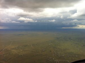
While on flight following we got treated to ATC rerouting several flights due to heavy precipitation over Denver. We stuck to our flight plan of MBW to CKW to OCS which kept us out of the rain. Here is a pic of the storm over Denver. It was enormous.
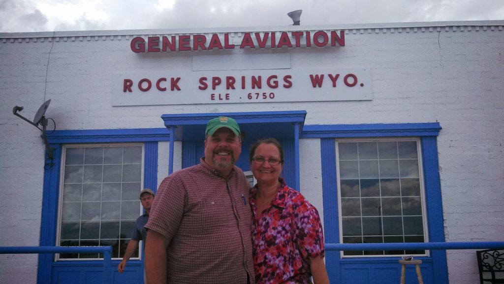
The ride into the mountains was turbulent. I was stuck below a near solid cloud layer at about 10,000 feet and bumped along all the way to KRKS. ATC lost us on Radar for a while between Medicine Bow and Cherokee, but picked us back up as we got closer to Rock Springs. Interesting note about the runways at KRKS the 09\27 runway is huge! (10,000 x 150 feet) I hesitated for a moment and had to check the sectional to confirm the runway altitude to set my pattern altitude.
The hospitality here was great we were warmly welcomed and chatted it up with the locals about flying conditions on the way in. Got a ride from some nice folks to our hotel. The following day we planned our travel to S75 Payette.
Day Three July 12th
Took off from KRKS Rock Springs early morning and had a very slow climb out. Density Altitude (DA) was already 2000+ at 8:00 am. The field is 6765 feet so DA was 8765+ feet at takeoff. With full fuel and 60 lbs under max weight, we rolled down the runway almost 5000 feet and then climbed ever so slowly at 50-100 feet per minute (fpm). At sea level a normal climb for this plane even fully loaded is around 500-600 fpm. This poor climbing performance made me a bit nervous because the mountain ridge ahead of us was about 8300 feet high. Slowly got to 8500 to clear the mountain ridge, then lowered the nose and flight-climbed to 10,500 feet.
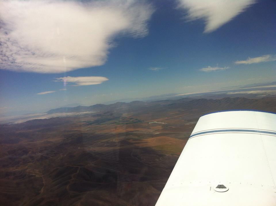
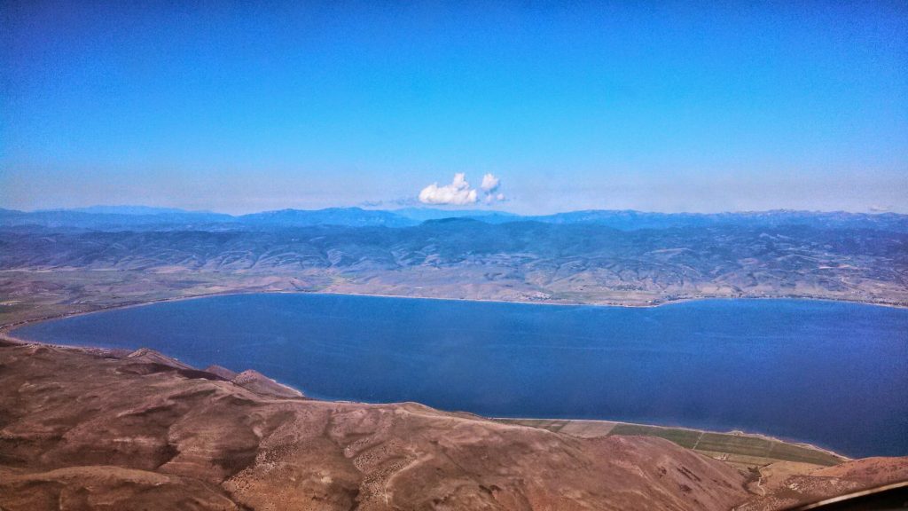
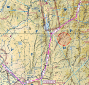
One part of the flight that was particularly scenic was the trip over Bear Lake.and through Logan Pass. We flew west towards and then over Bear Lake to the lakefront town of Garden City.
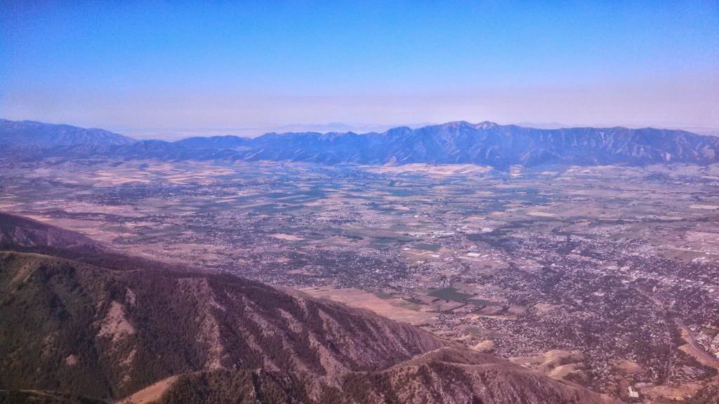
Once over the lake, we then followed the highway past Garden City to the west through the mountain pass into Logan Utah. Really something to see as we approached Logan and the mountain pass made a dramatic drop off a few thousand feet down into the valley where the city of Logan resides.
We continued our flight over the BYI to BOI VORs and then started our decent to S75 – Payette Municipal Airport in Payette, Idaho. Payette is a great little airport with friendly folks. They had the best price on Avgas, also offered 91 octane Mogas, and had a nice courtesy car. I made a bit of a bumpy landing coming in from the south as the rough terrain around the airport produced some turbulence.
I was a little worried about the climb out in the morning. We planned to take off early to the north for that slow climb up to altitude. The following day was the arrival at Johnson Creek. Day Four July 13th
We set out early from our hotel, drove the courtesy car back to the airport and departed from Payette. Actually had no problem at all taking off as Payette is 2228 ASL and the morning air in the valley was cool with no wind.
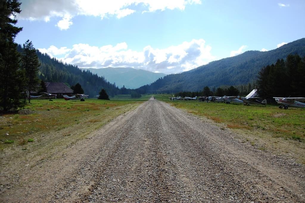
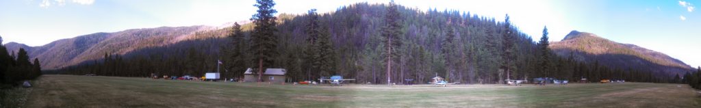
For our first landing at Johnson Creek Airport I chose the southern approach. That means I flew southeast from Payette, over Emmett field – S78, turned northeastward to horseshoe bend, then north along the railroad track up to Cascade airport. After that I turned northeastward and followed a road through the notch in the mountain range until I intercepted Johnson Creek. From there I turned north and followed the valley right into Johnson Creek Airport.
A brief note on landing at Johnson Creek. The preferred landing runway is 17 as the runway has a 10 degree upwards slope to the south. The canyon walls top out at about 8900 feet ASL but the runway is 4933 ASL. That means you have to fly the pattern at about 5900 feet very close to the runway. When approaching from the south you have to fly the downwind leg very close to the runway and very close to the trees in the canyon. For a first-timer this was intimidating! I found myself watching the trees and the altimeter and struggling to find the altitude that felt safe.
The landing pattern cannot be squared out like we might do back at home. I flew the plane north bound past the field to what is designated as the widest part of the canyon. At this point did a descending 180 degree turn to the left as I added flaps. This did not allow me to descend enough and I was high on final. This is a common rookie mistake. When I was abeam the numbers I should have been a maximum of 800 feet above the runway, however those trees looked really close at that altitude and I opted to stay a bit higher. To make the landing I did a side slip and held it almost all the way to the runway. My first landing was a bit steep and fast, but the runway is 3400 long so I had plenty of space to let the plane roll and burn off speed.
A couple of other points to consider. I was moving way faster in that thin air. Although my airspeed indicator said 70 knots it was in reality closer to 80 knots over the ground. Things happened fast. The direction of the wind through the canyon that day also created an updraft on my downwind leg. I was reducing power and still climbing. I had to push the nose down and reduce power quite a bit to get down to pattern altitude.
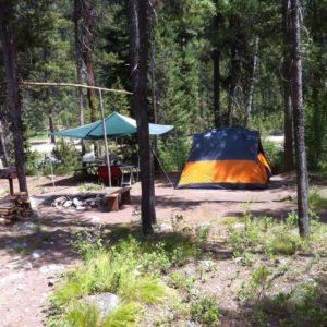
Once we landed at Johnson Creek. We camped for the next week. The daytime temperature was almost 100 degrees, at night the temperature would descend to about 45 degrees. This made for some cold nights. The good news is that there is a shed full of extra camping gear left behind and donated by other campers so we were able to find some extra sleeping bags!
The scenery here is breathtaking. The mountains are tall and steep and lush with green. The valleys are spectacular as they are full of life and beauty
Our campsite next to the river with all the comforts of home.
Day 8 July 17th
On this day we went to Sulfur Creek ID74, pronounced “crick”, for the famous $20 breakfast. Had a bit of haze during the flight in that we later discovered was smoke. The breakfast menu is very simple. Yes or No. The food was fantastic. The breakfast consisted of eggs, pancakes sausage, home-made apple butt and piping hot coffee. We were able to sit outside and watch other planes come in and land on the runway.
My landing was a bit of an adventure as I think I hit a gopher on landing. Look and see:
Sulphur Creek is a fly-in resort with lodge and cabins. The price to stay there was a bit steep, but you do get all your meals included plus a warm comfy bed in a cabin. After freezing a few nights I was tempted to plunk down the cash for a warm bed!
Remember when I mentioned back on day 1 where we flew through some precipitation near KMIO? Well, it seems that precipitation included some very abrasive droplets. The propeller on the plane was stripped nearly clean of all paint on the back side. I made arrangements with a prop shop in Boise Idaho to fix my prop and re-balance it.
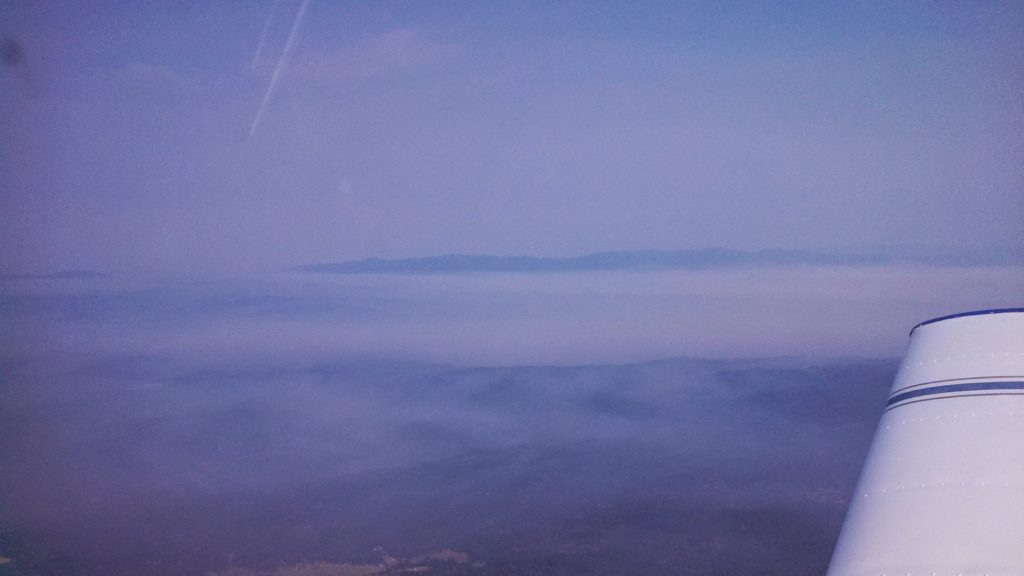
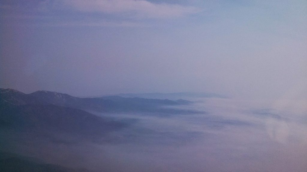
On the flight south from Sulfur Creek we flew to KBOI Boise Air Terminal/Gowen Field Airport to get the prop re-balanced. As we traveled south towards the airport the valleys were filled in with smoke and only the very peaks of the mountains were visible.
It was a strange experience to see the mountains this way, as only a few days earlier we saw them quite clearly. This also significantly reduced visibility. As I got closer to Boise I estimate I could see about 3 miles in the smoke, sometimes it was even less.
As I got about 20 nm from KBOI, I radioed approach to gain access to the Class C airspace. I was denied and was told to hold outside the airspace. I ended up flying a little racetrack pattern for about fifteen minutes while I waited. I was then granted svfr access and given a specific altitude and vector to fly. I did not see the actual runway until it was very close. Approach guided me to a left base for runway 10R and then turned me over to the tower.
The local prop shop kept my plane overnight and the wife and I spent the night in a local hotel. I slept almost 12 hours as sleep out there in the woods was not as warm and restful as I had hoped.
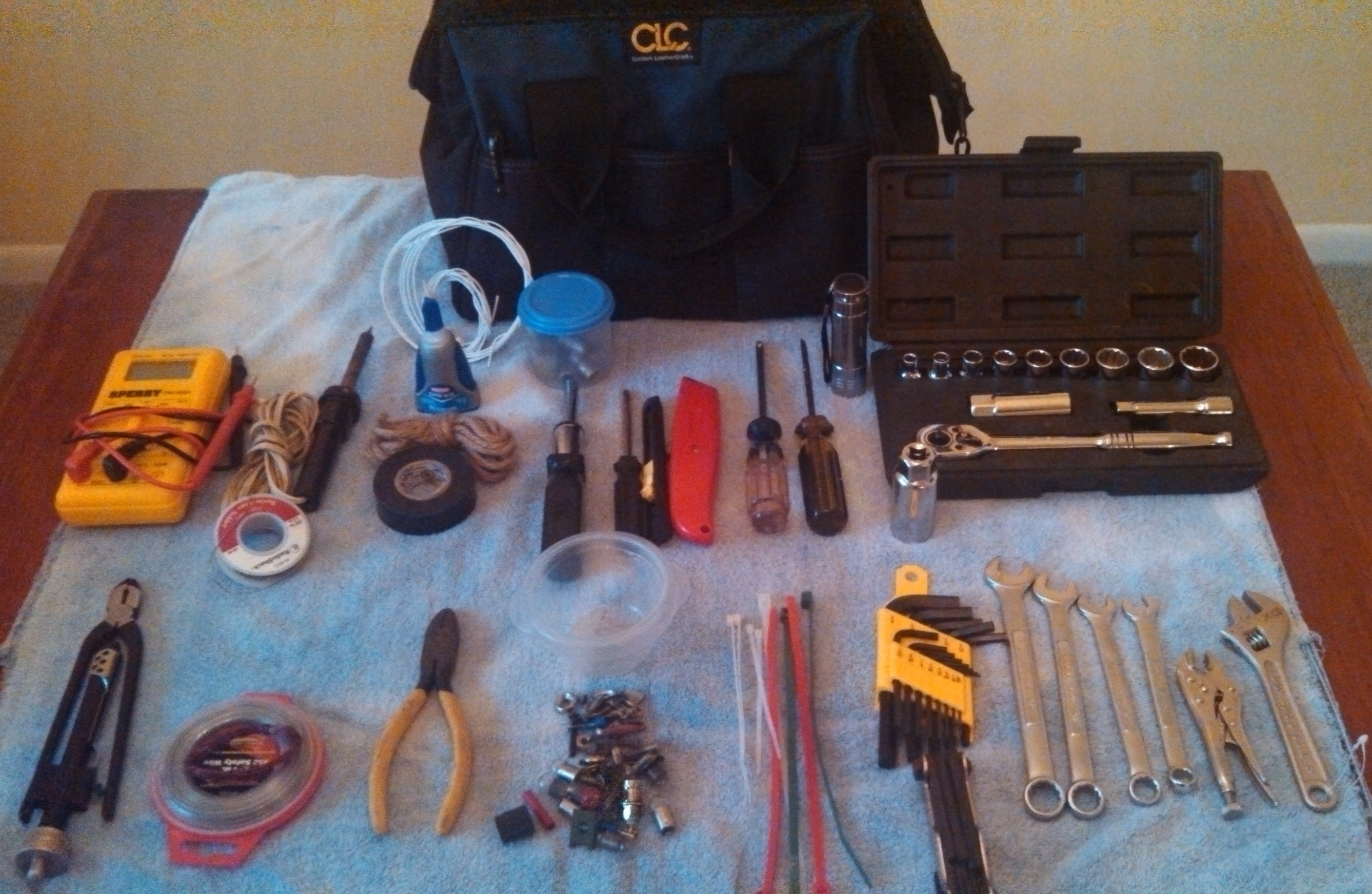
I wanted to create a small toolkit for my airplane. Nothing too fancy here. Just a simple tool bag that would cover the basic repairs I might encounter.
At the top is the toolbag bought at Big-Lots for $5.99
Top row left to right
Digital Volt/Ohm meter
Soldering Iron & Solder
Lengths of wire
Super glue gel (resealable)
Twine
Electrical tape
Ratchet screwdriver & bits in container
Small hex head driver
Box cutters
Medium hex-head driver
Medium flat-head driver
LCD Flashlight
3/8 socket set with extension
Sockets: 1/4-3/4
Spark Plug Socket
Second Row Left to Right
Twist Pliers
.032 Safety Wire (Aviation Grade)
Diagonal cutters
Mix of common bulbs, screws, fasteners in container

 I take a good amount of time in planning my route, which involves activities such as studying the terrain along my chosen path and making note of any distinctive landmarks or features. I also review approach procedures for my landing sites, and mentally note any alternate or emergency landing sites. I often go on YouTube and look for videos from other pilots that are flying routes and landing at the airports I might use. You would be surprised at how much you can glean from watching a video of someone landing at an airport you might use along your route.


 After refuel we took off and had to deal with the Class C airspace right next door. What a pain! instead of letting me turn west then north I had to turn south then east then north and go all the way around.
 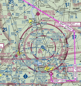 Quite frustrating but I understood afterward that had I gone east then north I would have ended up right in the middle of the approach path for incoming flights. We finally got back on track with flight following and continued to KMIO Miami Municipal Airport located in Miami Oklahoma. Quick note Miami is pronounced “my-am-a” at this particular location as it is a Native American word.
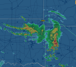
 It swayed and rattled but ran just great and got us to dinner and our hotel just fine. We had a great dinner at Montana Mike’s and then cruised Historic Route 66 in the courtesy car. While on Route 66 we saw a bunch of restored landmarks including an old gas station, a theater and several shops along the way.
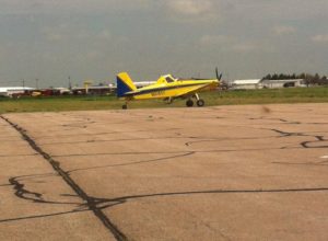 The airport itself was located in the middle of acres of corn fields. The runway seemed to be made of a series of cement tiles connected together, which made my tires click out a tune as we landed. I picked this airport because it was on our route and had some of the least expensive 100 octane low-lead fuel, commonly called 100LL for the plane. Our Piper Cherokee burns about 8 to 10 gallons of fuel in an hour and goes through 40 gallons every four hours of flight. Finding less expensive spots to stop for fuel really saved us some cash.
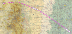
 Took off from KRKS Rock Springs early morning and had a very slow climb out. Density Altitude (DA) was already 2000+ at 8:00 am. The field is 6765 feet so DA was 8765+ feet at takeoff. With full fuel and 60 lbs under max weight, we rolled down the runway almost 5000 feet and then climbed ever so slowly at 50-100 feet per minute (fpm). At sea level a normal climb for this plane even fully loaded is around 500-600 fpm. This poor climbing performance made me a bit nervous because the mountain ridge ahead of us was about 8300 feet high. Slowly got to 8500 to clear the mountain ridge, then lowered the nose and flight-climbed to 10,500 feet.
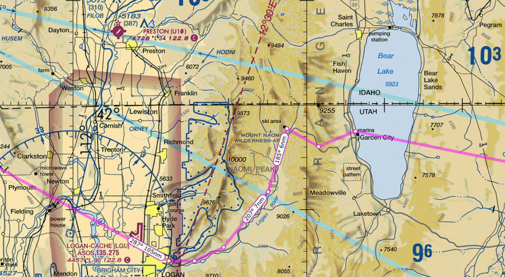
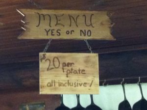 a bit of haze during the flight in that we later discovered was smoke. The breakfast menu is very simple. Yes or No. The food was fantastic. The breakfast consisted of eggs, pancakes sausage, home-made apple butt and piping hot coffee. We were able to sit outside and watch other planes come in and land on the runway.